
[ad name=”HTML-68″]
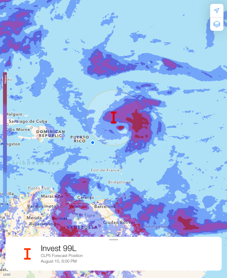
CHRISTIANSTED — The V.I. Freep‘s 2017 Tropical Storm Watch Team continues to monitor Invest 99L which was 282 miles away from St. Croix at 2 p.m. on Thursday.
Invest 99-L is still a very disorganized cluster of scattered showers and thunderstorms.
Models do keep moving the system to the northern side of the Lesser Antilles and British Virgin Islands, where some development remains possible, but it’s certainly a much less likely chance over the next five days.
The motto for the V.I. Freep Tropical Storm Watch Team for the 2017 Atlantic Hurricane Season is: “We actually live here, so we really care about the forecasts we produce — and the people who are affected by the weather patterns here.”
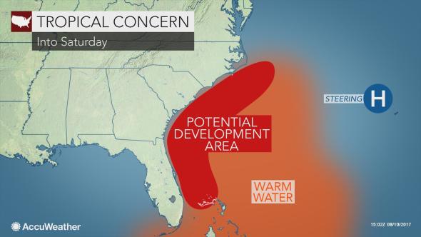
Meanwhile, a batch of thunderstorms along the east coast of Florida has the potential to develop into a tropical system and unleash heavy rainfall and raise seas to end the week.
“Thunderstorms between the Florida Peninsula and the northern Bahamas have begun to develop a circular motion,” according to AccuWeather Hurricane Expert Dan Kottlowski.
“It is possible this feature develops tropical characteristics with little notice,” Kottlowski said.
The close proximity to the coast adds to the level of concern.
People from the eastern part of the Florida Peninsula to the Carolinas and northern Bahamas should monitor this recent development as the feature could evolve into a tropical depression or storm with little notice.
This feature was the same system that produced torrential rainfall and flash flooding in the British Virgin Islands and St. Croix on Monday night.
At the very least, this system will enhance rainfall as it drifts northward and interacts with existing showers and thunderstorms over coastal areas of the southeastern United States into this weekend, Kottlowski stated.
The feature could increase the risk of flooding and produce locally gusty thunderstorms along the southern Atlantic Seaboard into Saturday.