SAN JUAN — A disturbance in the central Atlantic is vying to become the season’s next tropical depression or tropical storm and forecasters say it will enhance rainfall in the Virgin Islands and Puerto Rico.
This system has been dubbed Invest 96L, which is a naming convention used by the NHC to identify systems that have some potential to develop into a tropical depression or tropical storm.
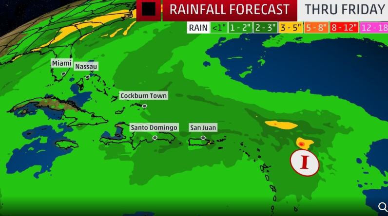
“According to the National Weather Service, San Juan, PR, Invest 96L is forecasted to bring one to four inches of rain to the territory beginning on Tuesday night into Thursday afternoon,” the Virgin Islands Territorial Emergency Management Agency (VITEMA) said. “Additional impacts to the territory is forecasted to include 8-10 ft. seas and 15-20mph winds with gusts up to 30mph. Due to dry air filtering the system, no further development is forecasted as it approaches the territory.”
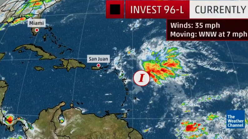
At 2:00 p.m. today, Invest 96L is located about 200 miles east of the Leeward Islands and continues to produce a large area of disturbed weather over much of the western tropical Atlantic Ocean, according to VITEMA.
As VITEMA continues to track the progression of Invest 96L, residents of the US. Virgin Islands are advised to:
• Stay informed using credible sources of information. Continue to monitor local weather reports for possible changes in the forecast.
• Receive real-time updates on Alert VI, the territory’s emergency notification system. You can register for Alert VI by visiting the VITEMA website at www.vitema.vi.gov
THE VIEW ON SOCIAL MEDIA OF VITEMA’S LAST? ALERT
Currently, Invest 96L is showing some signs of increased thunderstorm activity.
Wind shear – the change in wind speed and direction with height – is unfavorable for the formation of a depression or storm, but conditions could gradually become more favorable for development by Tuesday or Wednesday as wind shear decreases and ocean temperatures increase in the path of this system.
The NHC gives Invest 96L a high chance of development during the next five days with the most likely window for tropical development opening midweek. If this system gets named, it would be called “Patty.”
The system will be guided to the west-northwest through Wednesday or Thursday by a dome of high pressure located over the northern Atlantic. This will take Invest 96L near or just north of the Leeward Islands on Tuesday, then north of Puerto Rico and Hispaniola on Wednesday.
A surge of tropical moisture will spread across the northeast Caribbean as this system passes to the north. As a result, an increase in shower and thunderstorm activity can be expected in Puerto Rico and the Virgin Islands Tuesday night-Thursday.
Later Wednesday into Thursday, this system could approach the Turks and Caicos Islands and the southern or central Bahamas before the dome of high pressure scoots eastward and steering patterns begin to change for the system.
As is typical for the later months of hurricane season, a cold front will sweep off the East Coast of the United States late Thursday or early Friday. This boundary will also act as a shield for the United States and will redirect the system to the north and east for the end of the week.

