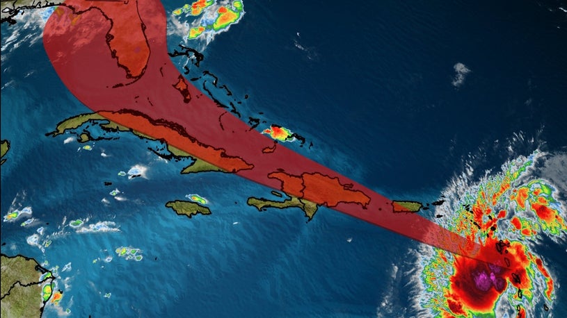
CHARLOTTE AMALIE — Potential Tropical Cyclone Nine was centered near Latitude 15.1 North, Longitude 62.1 West at 8 a.m. today. The system is moving toward the west-northwest near 23 miles per hour.
On the forecast track, the system will move near or over Puerto Rico tonight, near or over Hispaniola on Thursday, and near or over the southeastern Bahamas on Friday.
Maximum sustained winds remain near 45 miles per hour with higher gusts. Some increase in strength is forecast today, with weakening likely on Thursday due to land interaction, and some re-strengthening possible late week.
Environmental conditions are expected to be conducive for additional development, and a tropical storm is forecast to form later today.
Tropical-storm-force winds extend outward up to 275 miles primarily to the north and northeast of the center.
WIND: Tropical storm conditions are moving across portions of the Leeward Islands and will spread across the U.S. and British Virgin Islands and Puerto Rico this afternoon through Thursday morning. These conditions are forecast to reach portions of the Dominican Republic and Haiti within the warning area early Thursday. Tropical storm conditions are possible in the watch areas on Thursday.
RAINFALL: The potential tropical cyclone is expected to produce the following rain accumulations: Across the northern Leeward Islands, British and U.S. Virgin Islands: 3 to 6 inches. Across Puerto Rico: 3 to 6 inches, with isolated maximum totals of 10 inches

