MIAMI — The tropics continue to heat up as we work our way into the first week of October.
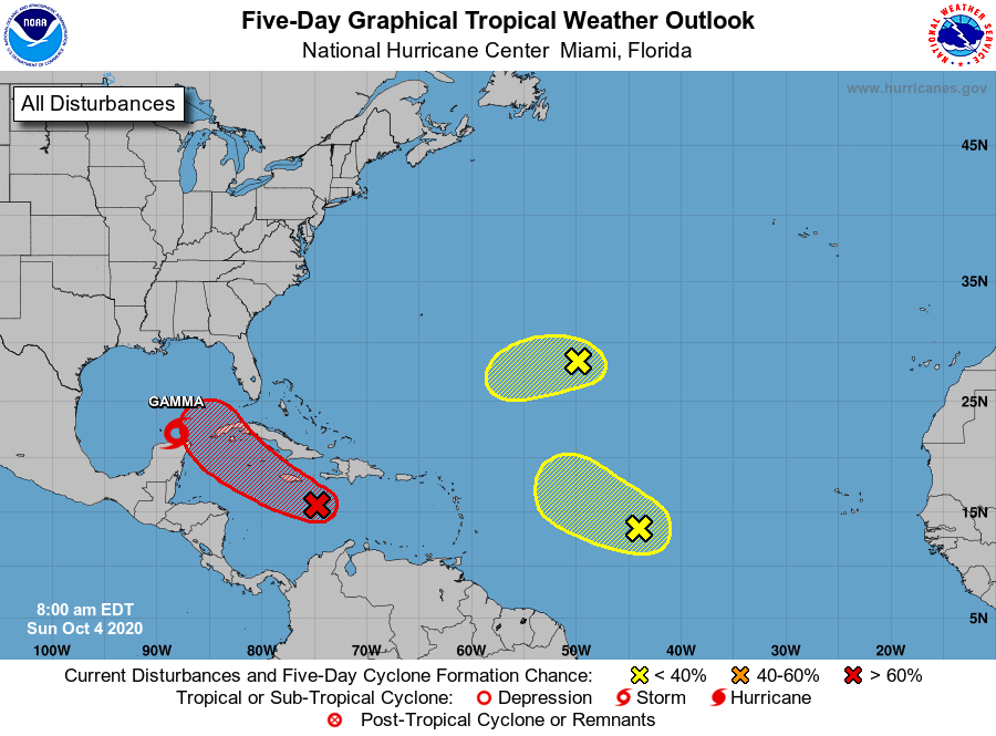
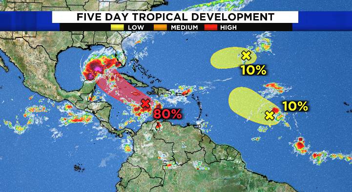
Tropical Storm Gamma, newly named Invest 92L and two other areas to watch out in the Atlantic highlight the busy week ahead.
Gamma made landfall in the Yucatan peninsula Saturday and has since emerged into the Gulf of Mexico. The storm is expected to make a hard west turn and meander in the Southern Gulf of Mexico/Bay of Campeche through the next week.
A second tropical wave in the Caribbean now has a 70 percent chance over the next 48 hours to become the 26th tropical depression of the 2020 season.
There is an 80 percent chance for development over the next five days. There is uncertainty in the exact future of this system, but it is likely to enter the Gulf of Mexico sometime in the week ahead.
Elsewhere in the Atlantic, a tropical wave producing limited thunderstorm activity continues to work its way across the Main Development Region.
Despite continued thunderstorm flare-ups, this system is slowly working its way towards strong wind shear, and is unlikely to develop. Chances of development are capped at 20 percent over the next five days.

Finally, in the central Atlantic, a large mid-level circulation continues to create limited thunderstorm activity. Believe it or not, this spin is a part of what used to be Hurricane Paulette, which formed back on September 7th.
Now it has lost its low-level circulation, meaning if it were to develop this system would gain a new name. Again, this system is in a highly unfavorable environment and is unlikely to develop.
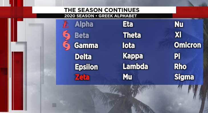
The next name on the list will be Delta.