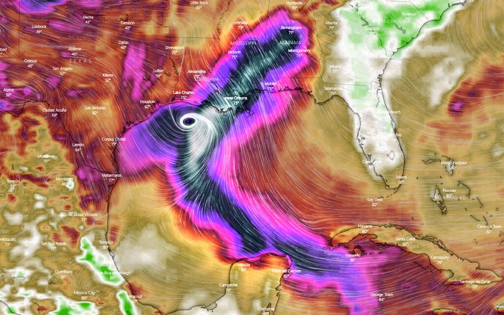
MIAMI — Tropical Storm Zeta stalled today in the western Caribbean, but forecasters said it posed the risk of a rain-heavy hurricane for Mexico’s resort-dotted Yucatan Peninsula and the United States Gulf coast.
In a historic hurricane season, Zeta is the earliest ever named 27th Atlantic storm. The previous earliest formed on 29 November 2005, said Colorado State University hurricane researcher Phil Klotzbach.
This year’s season has seen so many storms that the NHC has turned to the Greek alphabet after running out of official names. Zeta is the furthest into the Greek alphabet the Atlantic season has gone.
There was also a Tropical Storm Zeta in 2005, but that year had 28 storms because meteorologists went back and found they missed one, which then became a “unnamed named storm,” Klotzbach said.
Also today, Hurricane Epsilon was moving quickly through the northern portion of the Atlantic. Forecasters said it would become a post-tropical cyclone. Large ocean swells generated by Epsilon could cause life-threatening surf and rip current conditions along US east coast and Atlantic Canada in the next couple of days.
Zeta was centered about 275 miles south-east of Cozumel island in Mexico this morning, according to the National Hurricane Center (NHC). It was nearly stationary, though forecasters said it was likely to near the north-eastern tip of the Yucatan Peninsula or western-most Cuba by late Monday or early Tuesday and the US Gulf coast by Wednesday.
Zeta had maximum sustained winds of 40 mph and forecasters said it was expected to intensify into a hurricane by Tuesday. It may dawdle in the western Caribbean for another day or so, trapped between strong high pressure systems to the east and west. It cannot move north or south because nothing is moving there either, said University of Miami hurricane researcher Brian McNoldy.
“It just has to sit and wait for a day or so,” McNoldy said. “It just needs anything to move.”
When a storm gets stuck, it can unload dangerous downpours which cause flooding when a storm is over or near land. That happened in 2017 over Houston, Texas with Harvey, when more than 60in of rain fell, and in 2019 over the Bahamas with Dorian, a category 5 hurricane, the worst-case scenario for a stationary storm, said Klotzbach.
Zeta was over open ocean on Sunday but Jamaica and Honduras were seeing heavy rain because the system is so large. South Florida was under a flood watch, McNoldy said. The NHC said Zeta could bring 4in to 8in of rain to parts of the Caribbean and Mexico as well as Florida and the Keys before drenching parts of the central Gulf coast by Wednesday.
A 2018 study said storms, especially in the Atlantic basin, are slowing down and stalling more. Atlantic storms that made landfall moved 2.9mph slower than 60 years ago, the study found. Author James Kossin, a government climate scientist, said the trend has signs of human-caused climate change.
Zeta is in a dangerous place to stall. The western Caribbean is “where storms can cook” and rapidly intensify because of the deep, warm waters, like Wilma in 2005, Klotzbach said. However, the NHC was not forecasting rapid intensification and Klotzbach said Zeta would not stall over land.
The lack of steering currents also meant a wide spread of possible landfalls when Zeta heads north. The NHC said it could make landfall anywhere from Louisiana to the Florida Panhandle.
A hurricane watch was called for the Yucatan Peninsula from Tulum to Rio Lagartos today, including Cancun and Cozumel, while a tropical storm warning was in effect for Pinar del Rio, Cuba.

