


MIAMI — As Eta makes its way past Tampa Bay and Theta moves away from the United States, forecasters are keeping an eye on a tropical wave as the record-breaking Atlantic hurricane season continues.
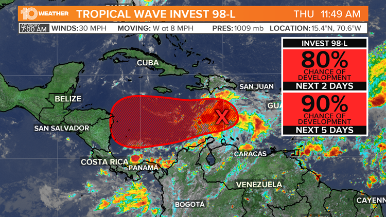
According to the National Hurricane Center, the tropical wave has a 90 percent chance of forming within the next three days, as of its morning update today. Now dubbed Invest 98-L, it is currently located in the center of the Caribbean Sea and slowly moving west.


In the next day or so, NHC forecasters say it will bring heavy rainfall along with possible flash flooding to the U.S. Virgin Islands, Puerto Rico and portions of Hispaniola.
If named, the storm will be named Tropical Storm Iota. This would be the record-setting 30th named storm of the Atlantic hurricane season. Tropical Storm Theta set the all-time record of 29 named storms for the Atlantic Basin, beating the 2005 season, which had 28 named storms.
After Iota, the names Kappa and Lambda would be used next. Hurricane season ends on November 30. However, in the record-setting year of 2005, named storms continued into December.
Tropical Storm Zeta occurred between December 30 and January 6 that year.
Most of the early models take Invest 98-L into Central America, so at this time, it does not look like this storm will have any impact on Florida.

