


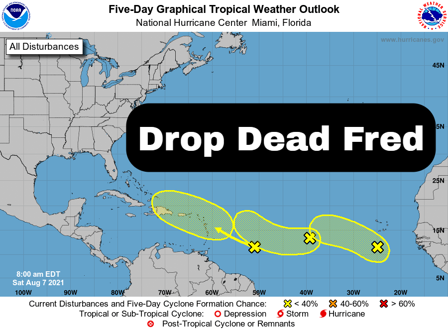
MIAMI — The National Hurricane Center is monitoring three disturbances in the tropical Atlantic this morning.
For the moment, 92L (#3 on graphic) which would be called “Fred,” is expected to bring rain activity to the U.S. Virgin Islands and Puerto Rico during a Tuesday-Wednesday timeframe, the National Weather Service said today.

1. A broad area of low pressure located a couple hundred miles south of the Cabo Verde Islands is producing disorganized showers and thunderstorms.  Although environmental conditions are only marginally conducive, some slow development of this system is possible during the next few days while the system moves west-northwestward to westward across the eastern and central tropical Atlantic at 10 to 15 mph.
* Formation chance through 48 hours...low...20 percent.
* Formation chance through 5 days...low...30 percent.

2. A small but well-defined area of low pressure located over the eastern tropical Atlantic about a thousand miles west of the Cabo Verde Islands continues to produce limited shower activity. Some development of this low is possible while it drifts toward the west-southwest or west over the weekend and then moves a little faster toward the west-northwest over the central tropical Atlantic by the middle of next week.
* Formation chance through 48 hours...low...20 percent.
* Formation chance through 5 days...low...30 percent.

3. A tropical wave located over the west-central tropical Atlantic is producing limited shower activity.  Significant development of this system is not anticipated as it moves west-northwestward across the Lesser Antilles and eastern Caribbean Sea during the early to middle part of next week.
* Formation chance through 48 hours...low...near 0 percent.
* Formation chance through 5 days...low...10 percent

