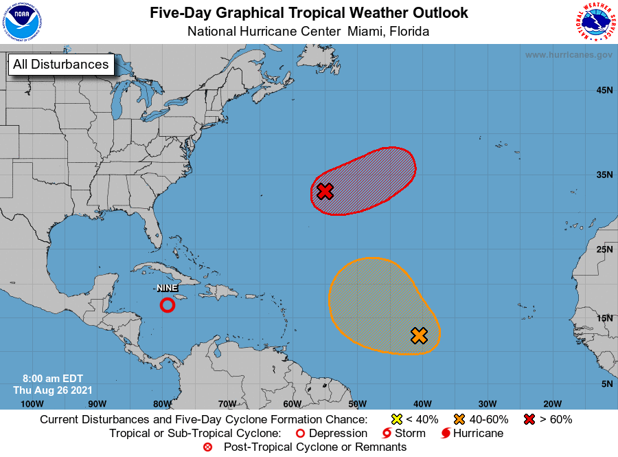
MIAMI — Tropical Depression Nine formed this morning in the Caribbean and could become a major hurricane by the time it reaches the northern U.S. Gulf Coast over the next several days.
The National Weather service in Miami said today that both the Cuban and Cayman governments have issued tropical storm warnings after the formation of Tropical Depression Nine.
The depression is expected to become a tropical storm by tonight, a hurricane tomorrow and possibly a major hurricane by the time it approaches the northern Gulf Coast.
According to the National Hurricane Center, at 11 a.m. EDT, the center of Tropical Depression Nine was located near latitude 16.9 North, longitude 79.2 West. The depression is moving toward the northwest near 13 mph, and this general motion should continue over the next few days. On the forecast track, the center of the depression will pass near of over the Cayman Islands tonight, the Isle of Youth and Western Cuba Friday, and move over the southeastern and central Gulf of Mexico Friday night and Saturday. The system is forecast to approach the U.S. northern Gulf coast on Sunday.
Maximum sustained winds are near 35 mph with higher gusts. Steady strengthening is forecast during the next few days. The depression is expected to become a tropical storm tonight, and become a hurricane when it is near western Cuba or over the southeastern Gulf of Mexico. Additional strengthening is likely over the Gulf of Mexico and the system could be near major hurricane strength when it approaches the northern Gulf coast.
EARLIER REPORT:
Expect highs to return to the low 90s today, with a heat index of around 100 degrees. Make sure you keep cool out there and stay hydrated! Our rain chances will be around 30% today but will increase quickly again as we move into the weekend.
A tropical disturbance will enter the Gulf this weekend and could become a hurricane before landfall. Where it will make landfall remains to be seen but the model consensus is that the Louisiana coastline will be the bullseye. That would still put us on the wet East side of the storm so we’ll be following this very carefully over the next few days. Two other tropical disturbances exist in the Atlantic but those are lifting north and won’t burden our area.

