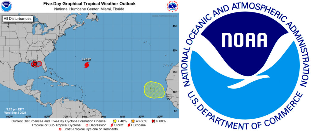
MIAMI — A previously lackluster storm system rapidly organized to become Tropical Storm Mindy this evening.
The National Hurricane Center said it would begin advisories for Tropical Storm Mindy and include tropical storm warning for parts of Florida.
As of 5 p.m. today, Mindy was 90 miles west-southwest of Apalachicola, Florida, with maximum sustained winds of 40 mph. The storm is moving northeast at 21 mph.
A Tropical Storm Warning has been issued for the coast of the Florida Panhandle from Mexico Beach to Steinhatchee River.
In a special tropical weather outlook at 3:20 p.m., the NHC said satellite and radar data indicated shower and thunderstorm activity related to the low pressure system about 115 miles southwest of Apalachicola was more organized.
Heavy rainfall is forecast for parts of the Florida panhandle and southern Georgia through tomorrow, with a threat of some flooding.
“If these development trends continue, advisories will likely be initiated on this system as a tropical depression or tropical storm later this afternoon, and tropical storm warnings could be required for portions of the coast of the Florida Panhandle,” the NHC stated.
The system would reach the coast by Wednesday night and move into the southeastern United States before emerging over the western Atlantic by late Thursday. Once in the Atlantic, conditions appear unfavorable for additional development.
If the system does develop into a tropical storm, it will be the 13th named storm of the year and take on the moniker Mindy.
As for Central Florida, shower odds will be at their most significant during the day Wednesday at 60% and falling to 20 percent in the evening, according to the National Weather Service. Thursday’s shower odds will also be at 60% throughout the day.
Meanwhile, Hurricane Larry continues to spin in the middle of the Atlantic. As of 5 p.m., the hurricane is 405 miles east-southeast of Bermuda, with maximum sustained winds of 110 mph and a forward speed of 15 mph.
Larry is a big hurricane with its hurricane-force winds extending up to 70 miles from its core and tropical-storm-force winds reaching up to 240 miles. Still, the storm does not immediately threaten land with its projected path forecast to turn northeast, but could target Newfoundland in Canada by Friday night.
Thankfully, Larry hasn’t made much of an impression with U.S. coastal residents. Still, the storm did break a record for the longest living major hurricane since 2019′s Hurricane Dorian, churning waves in the Atlantic with winds above 110 mph for five days before falling back to Category 2 on Wednesday morning, according to Philip Klotzbach, a meteorologist with Colorado State University.
Also, a tropical wave is expected to pop up off the the western African coast and onto the NHC’s radar in the next few days. Some development is possible and its odds of becoming a tropical depression are at 20% over the next five days.

