


MIAMI — A tropical depression or storm may develop in the eastern Atlantic and head toward the Windward Islands, then into the Caribbean Sea next week as the first month of the 2022 Atlantic hurricane season comes to a close.
The National Hurricane Center (NHC) is currently monitoring an area of showers and thunderstorms – referred to by meteorologists as Invest 94L — several hundred miles off the coast of western Africa.
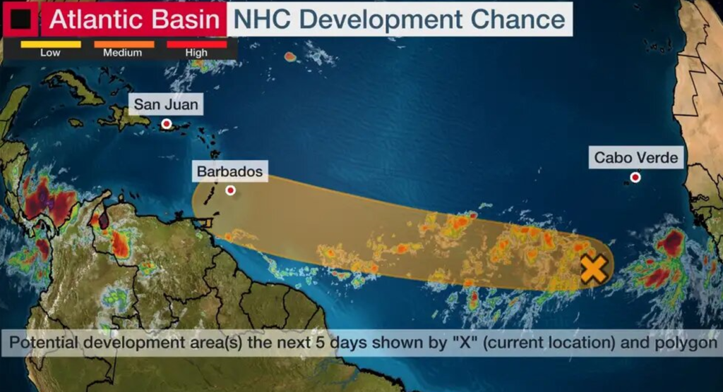
An invest is an area that the NHC is watching closely using advanced computer models and other resources.


These thunderstorms are caused by a weather disturbance known as a tropical wave – an elongated area of low pressure generated over Africa that moves westward into the Atlantic every three to four days during hurricane season.
These tropical waves are often seeds of future tropical storms and hurricanes.
In this case, the NHC suggests development could occur by early next week in the area circled in the map below. Over the past several days, many computer forecast models have also been suggesting development is possible.
If this system becomes a tropical storm, it would be named “Bonnie.”
Whether or not development happens, it appears this system will arrive in the Windward Islands Tuesday night or Wednesday with increased showers and gusty winds at the very least.
For now, those in the Windward Islands should monitor the forecast for changes over the next several days.
Beyond that, forecast models suggest the system will continue moving west or west-northwest into the Caribbean Sea late next week. It’s far too soon to tell what, if any, impacts it may have in the Caribbean.