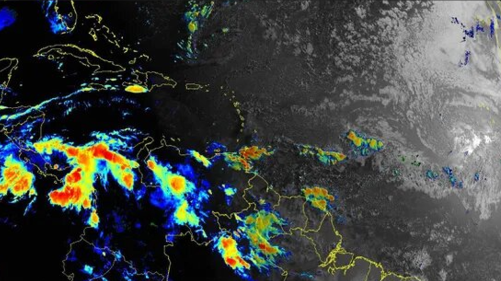
MIAMI — The National Hurricane Center is monitoring four tropical waves in the Atlantic basin, including one in the western Caribbean.
No new tropical cyclones are expected during the next five days as the busiest period of the Atlantic hurricane season approaches.
There have been four occasions in the past 30 years when the Atlantic has had no named storms between July 3 and today, according to Philip Klotzbach, meteorologist with Colorado State University.
There have been three named systems in the Atlantic so far this year, with the next named storm to be Danielle.
Water temperatures in the tropical Atlantic are on the high side, with the 30-day average between above-average and those seen during a hyperactive Atlantic hurricane season, according to Klotzbach.
The interaction of warm air and warm water spawns hurricanes, which is why they form over tropical waters. The rotation of the Earth makes them spin, according to NOAA.
When is hurricane season?
The Atlantic hurricane season runs from June 1 through November 30.
When is the peak of hurricane season?
What’s out there and where are they?
Tropical wave 1: A new tropical wave has moved off the coast of the western Sahara northeast of Cape Verde. It’s moving west at 11 mph.
Tropical wave 2: A tropical wave is located northwest of Cape Verde in the eastern Atlantic. It’s moving west at 17 mph.
Tropical wave 3: Another tropical wave is located in the central Atlantic east of the British Virgin Islands. It’s moving west at 15 mph.
Tropical wave 4: A tropical wave in the western Caribbean extends from eastern Honduras and Nicaragua to Costa Rica and into the eastern Pacific. It’s moving west at 19 mph.

