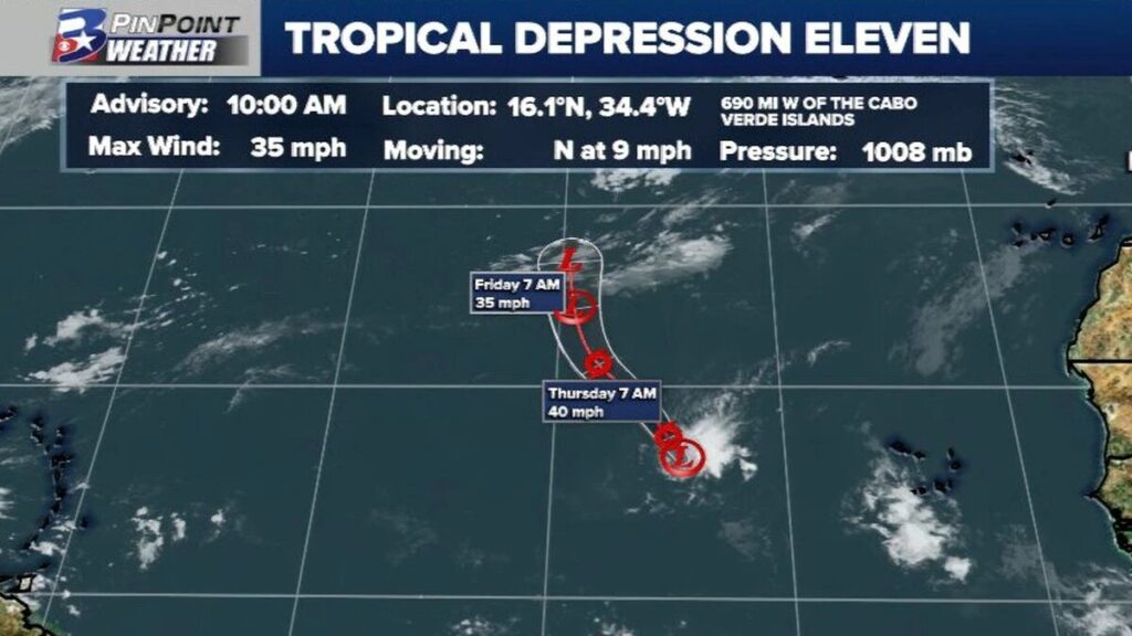
MIAMI — The National Hurricane Center has designated Tropical Depression Eleven just west of the Cabo Verde Islands as it slowly moves northward over the open Atlantic.
This storm is forecast to get caught up in the jetstream later this week and pose no true threat to land. It may briefly strengthen enough to become Tropical Storm Julia, according to the NHC.
“A wet and unstable weather pattern will prevail today and throughout the weekend,” NOAA’s Carlos Anselmi told the Virgin Islands Free Press today. “Periods of heavy rainfall due to thunderstorms may affect portions of the islands, especially during the afternoon. Urban and small stream flooding and isolated flash flooding will be possible.”
An upper-level trough over and northwest of the region will support another wet day today. Showers and thunderstorms are expected this afternoon, especially for western, northwestern, and interior portions of Puerto Rico. For the USVI, showers and isolated thunderstorms may move onshore from time to time.
Deep convection associated with the depression has become more concentrated overnight, but it remains well to the northeast of the low-level center due to moderate southwesterly vertical shear. Dvorak classifications from both TAFB and SAB remain T2.0 or 35 mph (30 knots).
Jetstreams are relatively narrow bands of strong wind in the upper levels of the atmosphere. The winds blow from west to east in jet streams but the flow often shifts to the north and south.
For a live look at where Tropical Depression Eleven is in regards to your location click on the live link below:
[wpedon id=23995]
