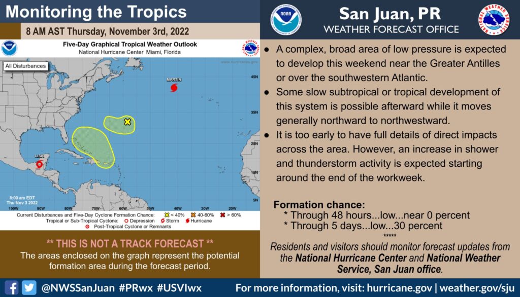
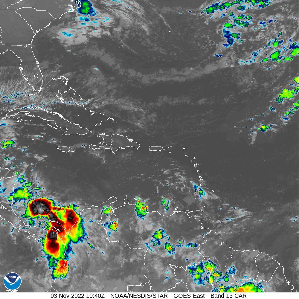
SAN JUAN — The combination of a polar trough and increasing moisture from the south will result in a very unsettled weather pattern beginning late Friday and stretching into early next week, the National Weather Service said today. For this reason, a Flash Flood Watch was issued by the NWS.
Impacts:
-Increasing showers and thunderstorms will enhance the risk of urban, river and flash flooding across the area.
– Although all the forecast areas will be prone to flooding, the southern and eastern half of Puerto Rico, Vieques, Culebra and the U.S. Virgin Islands are expected to receive the greater amounts.
– 3 to 6 inches of rain are expected, with higher isolated amounts.

-Marine and coastal conditions will also deteriorate this weekend, due to a combination of increasing winds and a northerly swell.
– Expect seas 7 to 10 feet, with winds out of the south southeast at 20 to 25 knots, and stronger gusts.
– High rip current risk and dangerous breaking waves expected.
The NWS will be conducting a webinar to discuss the weather conditions, tomorrow at 11:00 in Spanish and at 11:30 AM in English.
[wpedon id=23995]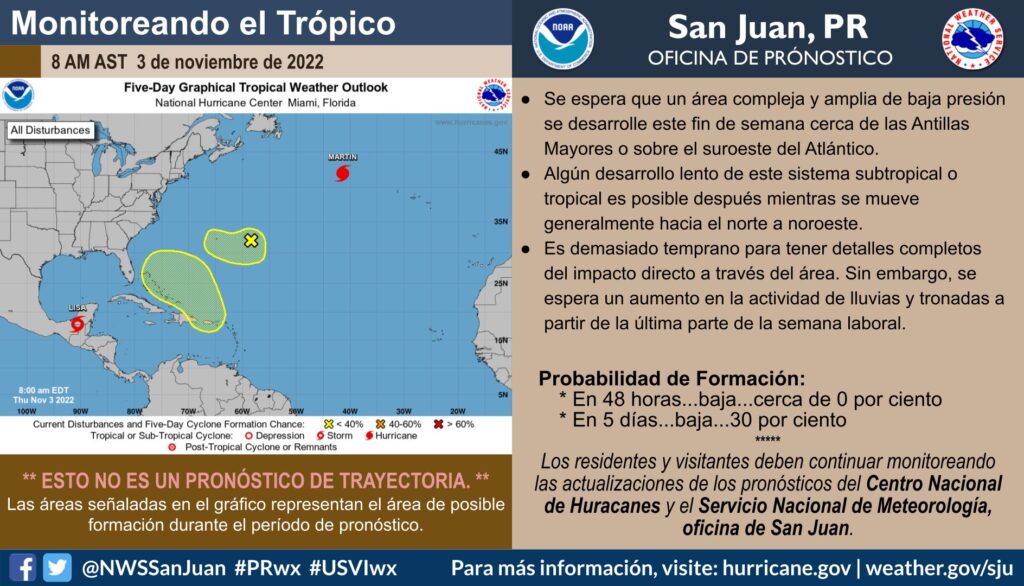
La combinación de una vaguada polar y un aumento en la humedad desde el sur resultará en condiciones del tiempo bien inestables comenzando tarde el viernes y extendiéndose hasta temprano la próxima semana. Por esta razón, se emitió una Vigilancia de Inundaciones Repentinas.
Impactos:
– Un aumento en los aguaceros y tronadas incrementará el riesgo de inundaciones urbanas, de ríos y repentinas.
– Aunque toda la región estará propensa a inundaciones, se espera que la mitad sur y este de Puerto Rico, Vieques y Culebra, así como las Islas Vírgenes de los Estados Unidos reciban las cantidades más altas.
– Se esperan de 3 a 6 pulgadas de lluvia, con cantidades aisladas más altas.
– Las condiciones marítimas también se deteriorarán, por la combinación del aumento en el viento y una marejada del norte.
– Se espera oleaje de 7 a 10 pies con vientos del sur sureste de 20 a 25 nudos, y ráfagas más fuertes.
– Se espera riesgo alto de corrientes marinas y olas rompientes peligrosas.
Estaremos realizando un seminario virtual para discutir las condiciones del tiempo en español a las 11:00 AM y en inglés a las 11:30 AM AST (enlace adjunto).
[wpedon id=23995]