SAN JUAN — The swell forerunners are beginning to reach the Atlantic Coastline, and coastal and marine conditions will worsen starting tonight, the National Weather Service said.
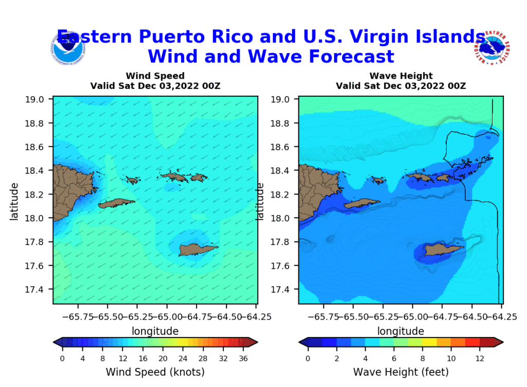
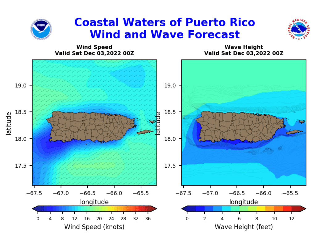
Breaking waves between 6 and 10 feet can be expected by this evening, continually increasing to between 10 and 15 feet late Sunday night into Tuesday.
Mariners can expect a northeasterly swell between 5 and 7 feet, with occasional higher heights, with a period ranging between 10 and 13 seconds, moving across the Atlantic Waters and Caribbean Passages through the middle of next week. The swell will peak late Sunday night into Tuesday, increasing seas to around 10 feet with occasional seas up to 13 feet.

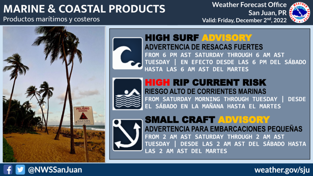
HAZARDS:
- Expect life-threatening rip currents due to dangerous breaking waves between 6 and 10 feet along Puerto Rico and Culebra’s north and northeast-facing beaches.
- Dangerous surf conditions due to breaking waves between 10 and 15 feet are expected late Sunday night through at least Tuesday along the beaches from the northwest to the northeast coast of Puerto Rico and Culebra, producing localized beach erosion and dangerous swimming conditions.
- Hazardous marine and coastal conditions due to a northeasterly swell with a height of 5-7 feet and a period between 10 and 11 seconds are expected across the Atlantic Waters and Caribbean Passages tonight, increasing between 8 and 10 feet with 11-13 seconds late Sunday night through Tuesday.
- St. Thomas and St. John can expect a high risk of rip currents due to breaking waves between 6 and 9 feet from early Sunday morning onward.
- St. Croix and Vieques can expect a high risk of rip currents due to breaking waves between 6 and 9 feet Sunday evening and onward.