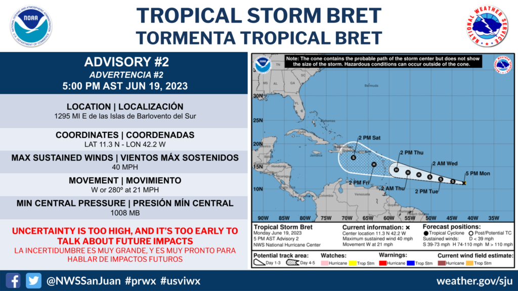
SAN JUAN — Satellite images indicate that the area of low pressure located roughly midway between Africa and the Lesser Antilles has become better organized overnight and is close to becoming a tropical cyclone.
If current trends continue, advisories could be initiated on a tropical depression later today.
This system is forecast to move generally westward at 15 to 20 mph with further development
across the central tropical Atlantic through the middle part of this week.
Additional information on this system, including storm warnings, can be found in High Seas Forecasts issued by the National Weather Service.

