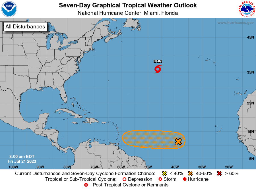
MIAMI — A disturbance tracking through the central Atlantic could form into a tropical depression over the next several days as it marches closer to the Caribbean.
The disturbance, which rolled off the coast of Africa on Monday, will make its long voyage westward across the open Atlantic over the next week.
This system has been designated Invest 95L by the National Hurricane Center (NHC). It’s a naming convention used by the NHC to identify tropical disturbances that have some chance to develop into a tropical depression or storm.
The NHC has given Invest 95L a medium chance of development over the next seven days. If development does occur during this period, it is more likely late this weekend or next week.
Warm water is abundant, but dry air is a factor against development. Despite the headlines of record warm water temperatures in the Atlantic, the atmosphere still has to cooperate for tropical development to occur.
This particular wave will have to persevere through dry air over the next several days in order to reach the Caribbean or western Atlantic.
Across much of the Atlantic, there is a deep well of both dry air and Saharan dust that stretches from northwestern Africa to Hispaniola. Each factor degrades the moisture content surrounding disturbances and makes it more difficult for them to develop.

