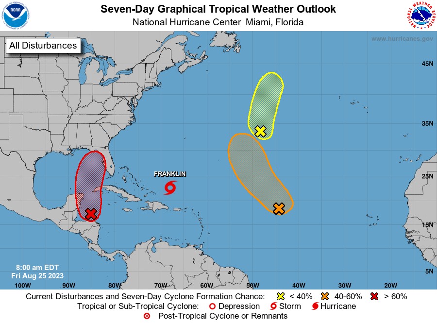
MIAMI — The National Hurricane Center continues to monitor Tropical Storm Franklin and three zones of potential development (with low to high chance) across the Atlantic Basin and the Gulf of Mexico.
Franklin is located a couple of hundred miles east-northeast of the Turks and Caicos Islands.
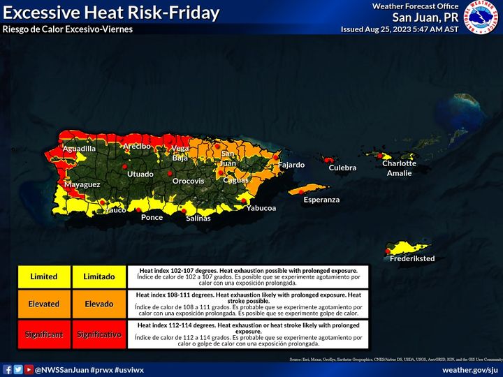
Closer to home, a Heat Advisory and Heat Warnings will be in effect from 10:00 a.m. to 5:00 p.m. AST across most urban and coastal areas of Puerto Rico, Culebra and Vieques.
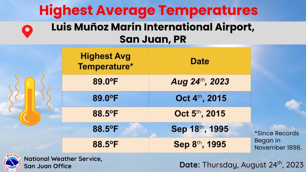
Puerto Rico had not only the highest maximum temperature yesterday, but on average, the island tied the highest average temperature recorded at the Luis Muñoz Marín International Airport station.
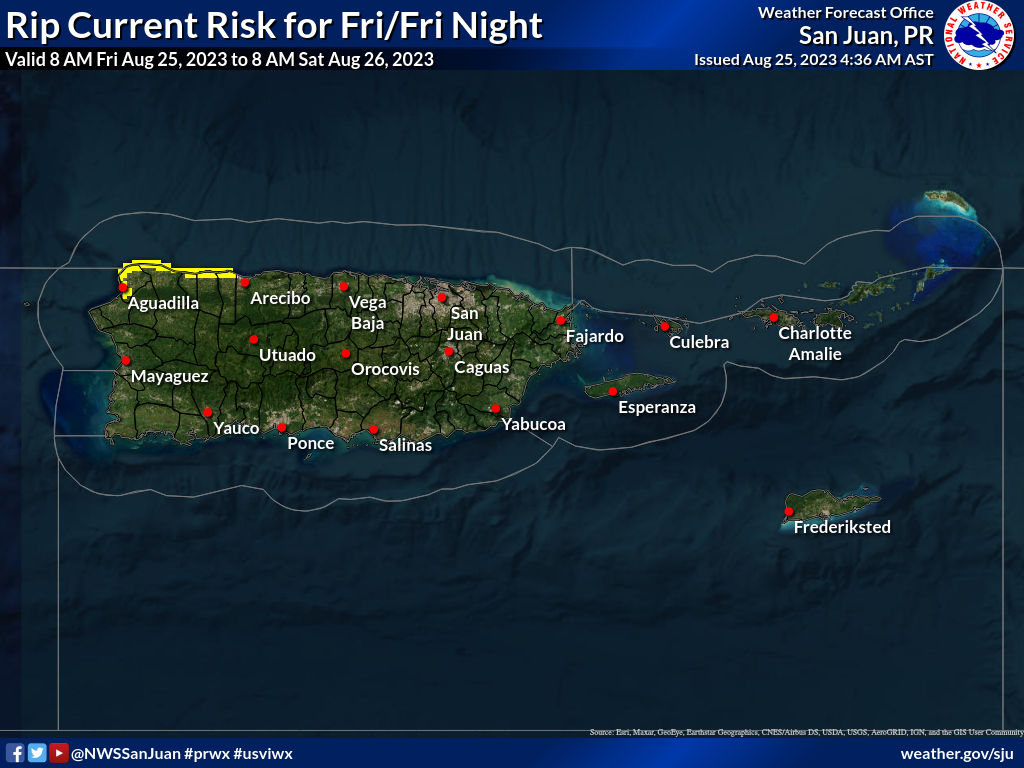
Moderate Risk of rip currents for northwestern Puerto Rico. Low risk for the rest of the islands.

Central Tropical Atlantic
Disorganized showers and thunderstorms continue in association with an area of low pressure located about midway between the Cabo Verde Islands and the northern Leeward Islands.
Environmental conditions could become more conducive for development this weekend, and a tropical depression could form by early next week while the system moves generally northwestward toward the central subtropical Atlantic.
* Formation chance through 48 hours…low…20 percent.
* Formation chance through 7 days…medium…50 percent.

Central Subtropical Atlantic (Remnants of Emily)
A trough of low pressure located roughly 1000 miles east-northeast of Bermuda (the remnants of former Tropical Storm Emily) is producing an elongated area of disorganized showers and thunderstorms.
Environmental conditions are becoming less favorable for tropical cyclone formation, and the low is expected to merge with a frontal boundary over the north central Atlantic in the next day or so.
For additional information on this system, including gale warnings, see High Seas Forecasts issued by the National Weather Service.
* Formation chance through 48 hours…low…20 percent.
* Formation chance through 7 days…low…20 percent.

Northwestern Caribbean Sea and eastern Gulf of Mexico
A broad area of low pressure over the northwestern Caribbean Sea is producing disorganized showers and thunderstorms.
Environmental conditions appear conducive for gradual development of this system during the next several days, and a tropical depression is likely to form late this weekend or early next week while moving generally northward over the northwestern Caribbean Sea and eastern Gulf of Mexico.
Interests in the Yucatan Peninsula of Mexico, western Cuba, and Florida should monitor the progress of this system.
* Formation chance through 48 hours…low…30 percent.
* Formation chance through 7 days…high…70 percent.