


MIAMI — After a tropical slumber, the Atlantic is showing signs of life as we creep toward August.
The Atlantic has been accumulating Saharan dust since Beryl’s demise roughly three weeks ago, but computer guidance is now hinting that we may get a tropical system in the last few days of July or into early August.
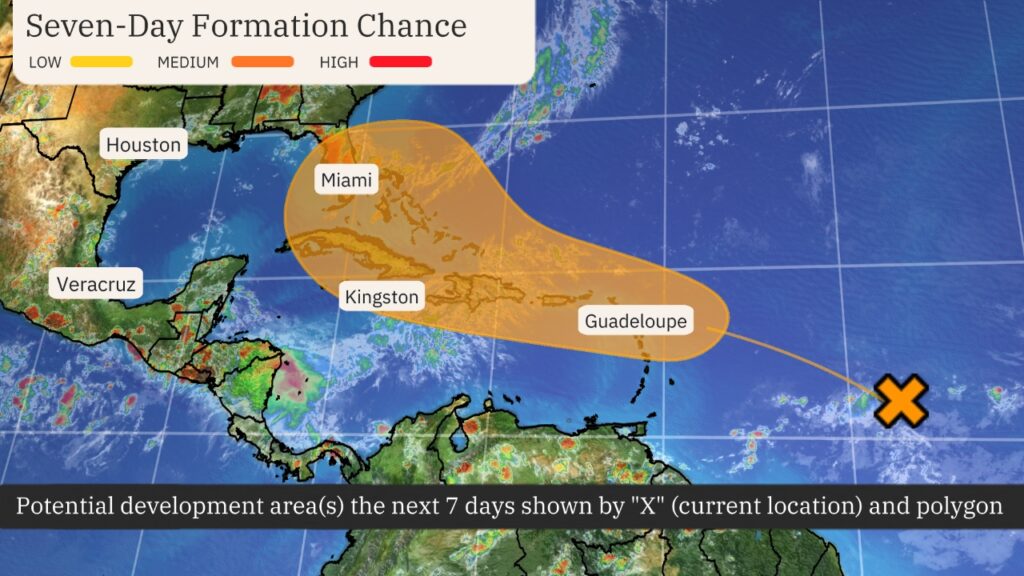
The Central Atlantic is expected to aggregate spin and moisture during the next few days as a tropical wave crosses the Main Development Region. Development is expected to be slow due to Saharan air and dry air lingering in the region, but conditions could be more conducive for development closer to the Antilles.
The National Hurricane Center currently says there is a medium chance of development over the next seven days.
Model guidance is far from unanimous on whether this system will form into a tropical depression or storm and where it will go once it passes Puerto Rico.
Conditions will generally be favorable for development ahead of this system.


Water temperatures are in the mid to upper 80s, which is slightly above average for late July. The moisture packet that the tropical wave will bring should be large and sufficient to keep the system from drying out. Wind shear should also be light to moderate until it reaches the longitude of the Bahamas.
This activity comes amidst the beginning of the most active time of the year in the tropics and a wave of more favorable atmospheric conditions known as the favorable phase of the Madden-Julian Oscillation. This wave travels around the globe once every 40 or so days and gives a boost to the tropics as it passes over. Recently, a Category 4 typhoon and tropical storm formed in the western Pacific after a cyclone drought similar to what has been seen in the Atlantic.
System a Caribbean threat, but future unknown: The tropical disturbance will be steered west-northwestward by the Bermuda High.
Given the likely track near the Greater Antilles (Puerto Rico, Hispaniola, and Cuba), terrain will have to be factored into the forecast. A track over any of these islands could disrupt and weaken the system.
Regardless of formation, heavy rain is possible in the Antilles over the next week.
Beyond that, the strength, orientation and extent of this dome of high pressure will determine the ultimate track of this system closer to the US.

A stronger Bermuda High would push this system, in whatever form it may come, toward Cuba, Florida or the Gulf of Mexico.
A weaker dome of high pressure might allow the system to ride its periphery in a clockwise trajectory off the US East Coast.
Right now, it is too early to suggest which end of this spectrum may play out.
Activity typically ramps up in August: If this system waits to form until Thursday, it will be in August.
August, September and October are typically regarded as the peak of the Atlantic hurricane season. This is because water temperatures are often at their warmest, wind shear is at its lowest and humidity has increased across the basin.
The corridor where this upcoming system will traverse is a common one for storms in August.
