


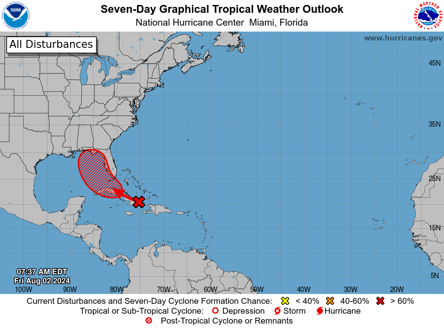
MIAMI — A well-defined tropical wave is producing a large area of poorly organized showers and thunderstorms over eastern Cuba, Hispaniola, the southeastern Bahamas, and Jamaica, as well as the adjacent waters of the southwestern Atlantic and the Caribbean Sea.
The wave is expected to move near or over Cuba throughout the day and then emerge over the Straits of Florida tonight or Saturday.
Environmental conditions are expected to be conducive for additional development after that time, and a tropical depression is likely to form this weekend over the Straits of Florida or eastern Gulf of Mexico near the Florida Peninsula.


Tropical storm watches or warnings could be required for portions of Florida later today.
Regardless of development, heavy rains could cause areas of flash flooding across Florida, Cuba, and the Bahamas through the weekend, and interests in these locations should continue to monitor the progress of this system.
A NOAA Hurricane Hunter aircraft is scheduled to investigate this system later today.
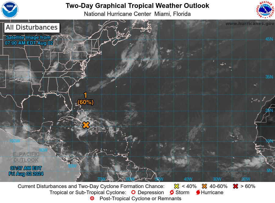
* Formation chance through 48 hours…medium…60 percent.
* Formation chance through 7 days…high…90 percent.
