SAN JUAN — A tropical wave located a few hundred miles east of the Windward Islands is producing a broad area of showers and thunderstorms.
Some slow development of this system is possible over the next week as the system moves quickly westward at around 20 miles per hour, crossing the Windward Islands early this week and moving into the central and western Caribbean by the mid to latter part of this week.
* Formation chance through 48 hours…low…10 percent.
* Formation chance through 7 days…low…20 percent.
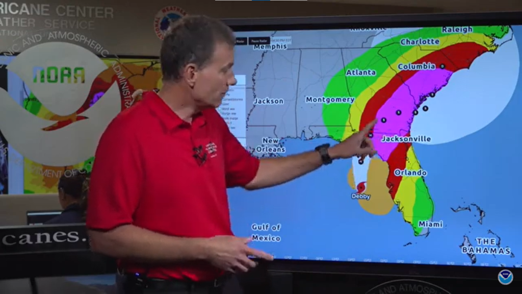
Meanwhile, Tropical Storm Debby is expected to rapidly intensify as it track through the Gulf of Mexico and is expected to become a hurricane before landfall in Florida’s Big Bend region tomorrow. Debby will then slow down and may result in serious flooding across the Southeast.
Debby will bring flooding rainfall, gusty winds, coastal flooding and a few tornado across the Florida Peninsula Sunday and then along the Southeast coast early in the coming week, where it could slow down or even stall, prolonging impacts.
A hurricane watch is in effect west of the Ochlockonee River to Indian Pass and from east of the Suwannee River to Yankeetown. Tropical storm warnings and watches cover the rest of western Florida, from the Keys to north of Tampa Bay and the central Panhandle region. A tropical storm watch has also been issued for the Georgia and South Carolina coasts from the mouth of St. Mary’s River to South Santee River.
A storm surge warning has also been issued in the Florida Big Bend from Aripeka northward to the Indian Pass. A storm surge watch continues southward from that area to Bonita Beach and northward to Aripeka.
This includes Tampa Bay and Charlotte Harbor. A storm surge watch has also been posted for the Georgia coast from the mouth of St. Mary’s River to the South Santee River Life-threatening storm surge is possible in these areas.

