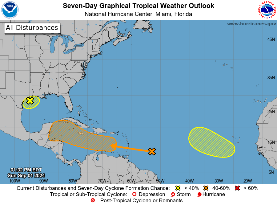
SAN JUAN — Shower activity associated with a tropical wave located several hundred miles east of the Lesser Antilles has changed little in organization since yesterday.
Some slow development is possible as the disturbance moves westward and reaches the Lesser Antilles tomorrow.
The wave is expected to move across the central and western Caribbean Sea later this week, where conditions are forecast to become more conducive for some development, and a tropical
depression could form during that time.
Regardless of development, this system could result in some gusty winds and locally heavy rainfall over portions of the Lesser Antilles tomorrow.
An excessive heat warning remains in effect for St. Croix from 10:00 a.m. to 5:00 p.m. today.
* Formation chance through 48 hours…low…10 percent.
* Formation chance through 7 days…medium…40 percent.
Eastern Tropical Atlantic Ocean
A tropical wave over western Africa is forecast to move offshore tomorrow.
Thereafter, environmental conditions could support some slow development throughout the week while the system moves slowly westward or west-northwestward over the eastern tropical Atlantic
Ocean.
* Formation chance through 48 hours…low…near 0 percent.
* Formation chance through 7 days…low…20 percent.
Northwestern Gulf of Mexico
A broad area of low pressure near the upper Texas coast continues to produce some shower and thunderstorm activity along and just offshore of the coasts of Texas and Louisiana.
This system is expected to linger near the coast for the next several days, and some slow development is possible if it remains offshore.
Regardless of development, heavy rains could cause some flash flooding across portions of coastal Louisiana and the upper Texas coast during the next few days.
* Formation chance through 48 hours…low…10 percent.
* Formation chance through 7 days…low…20 percent.

