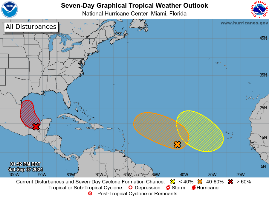
SAN JUAN — An elongated trough of low pressure over the eastern and central tropical Atlantic is producing a broad area of shower and thunderstorm activity.
A more well-defined area of low pressure may form within this region during the next few days.
Some slow development of this system is possible while the disturbance meanders through the early part of next week, then begins to move west-northwestward across the central tropical Atlantic during the middle to latter part of next week.
An excessive heat warning remains in effect for St. Croix from 10:00 a.m. to 5:00 p.m. today.
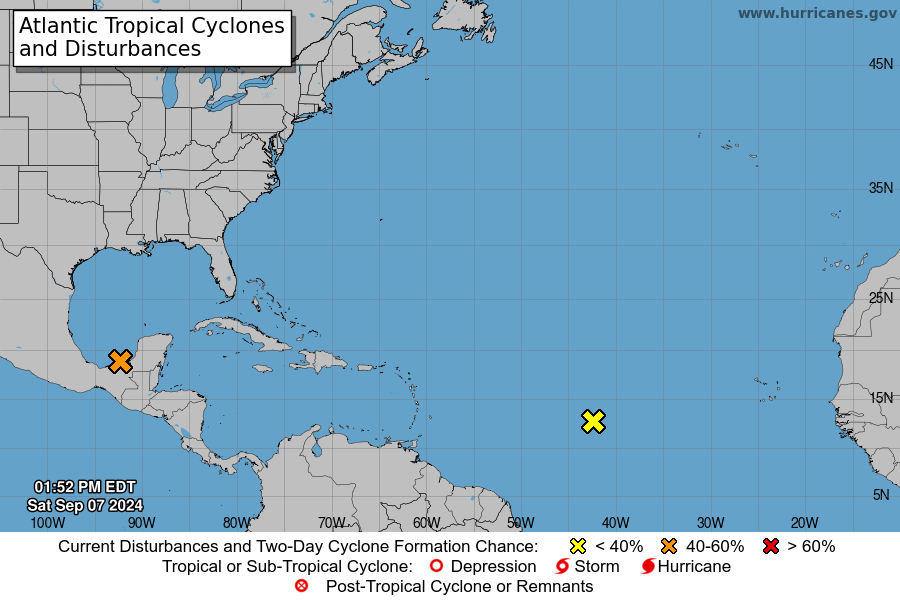
* Formation chance through 48 hours…low…near 0 percent.
* Formation chance through 7 days…low…30 percent.
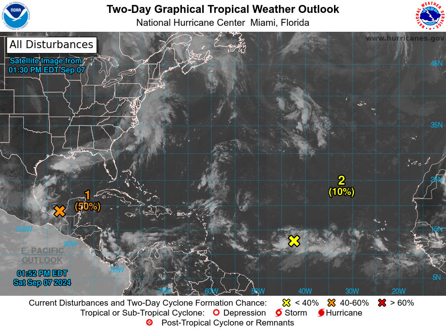
Southwestern Gulf of Mexico
A tropical wave over the Bay of Campeche is producing disorganized showers and thunderstorms.
An area of low pressure is forecast to develop while the wave interacts with a frontal boundary during the next couple of days.
Environmental conditions are forecast to be conducive for development, and a tropical depression could form during the early or middle part of next week while the system moves slowly northwestward to northward over the southwestern Gulf of Mexico.
* Formation chance through 48 hours…medium…40 percent.
* Formation chance through 7 days…medium…60 percent.