


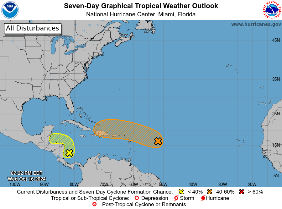
MIAMI — The National Hurricane Center is currently monitoring Invest 94-L and a second disturbance in the Caribbean.
Invest 94-L, a broad area of low pressure located over the central tropical Atlantic, could become a tropical depression late this week, the NHC says.
Currently producing disorganized showers and thunderstorms, Invest 94-L was previously embedded in a dry, unfavorable environment that prevented it from developing any further.

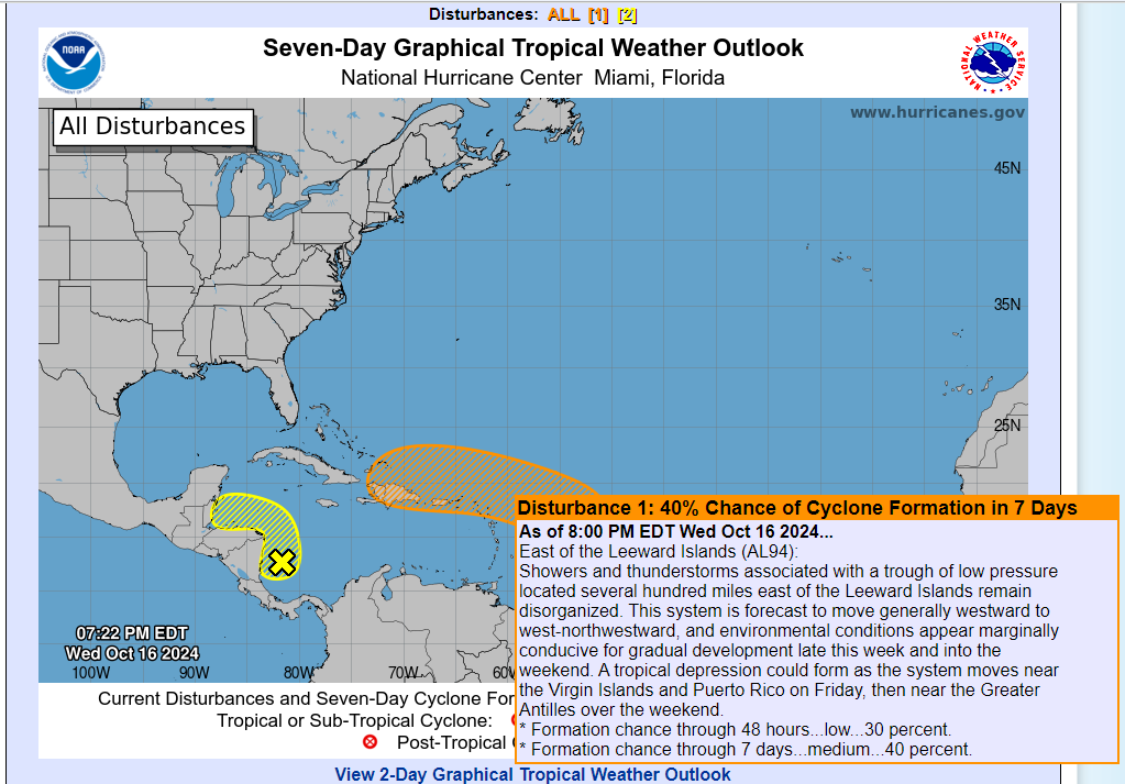
Now, as the system moves generally westward, the NHC says conditions could become marginally conducive for formation, with gradual development beginning late week.
As the system nears the Leeward and Virgin Islands, the NHC thinks a tropical depression could form.. Current models show an insignificant system moving into the Caribbean, where it could interact with land and die out.
Formation chances are pretty low and have slightly decreased over the week. In the next 48 hours, the NHC says there is a 30% chance of this system developing. Those odds are just 40% in the next seven days.
With very little data at this time, model information should be taken loosely. When, if ever, the system develops, models will become more consistent in terms of path and intensity.
There is plenty of time to monitor the system and lots of unknowns, so no need to panic.

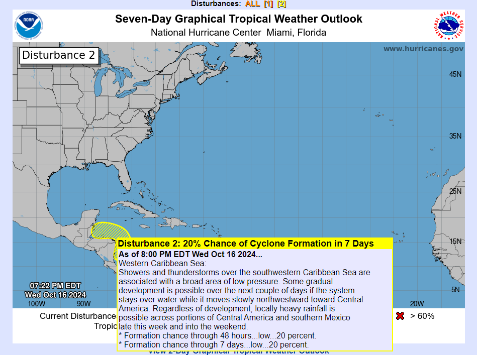
Western Caribbean Sea
Showers and thunderstorms over the southwestern Caribbean Sea are associated with a broad area of low pressure.
Some gradual development is possible if the system stays over water while it moves slowly northwestward towards Central America.
Regardless of development, locally heavy rainfall is possible across portions of Central America later this week.
* Formation chance through 48 hours…low…20 percent.
* Formation chance through 7 days…low…20 percent.
