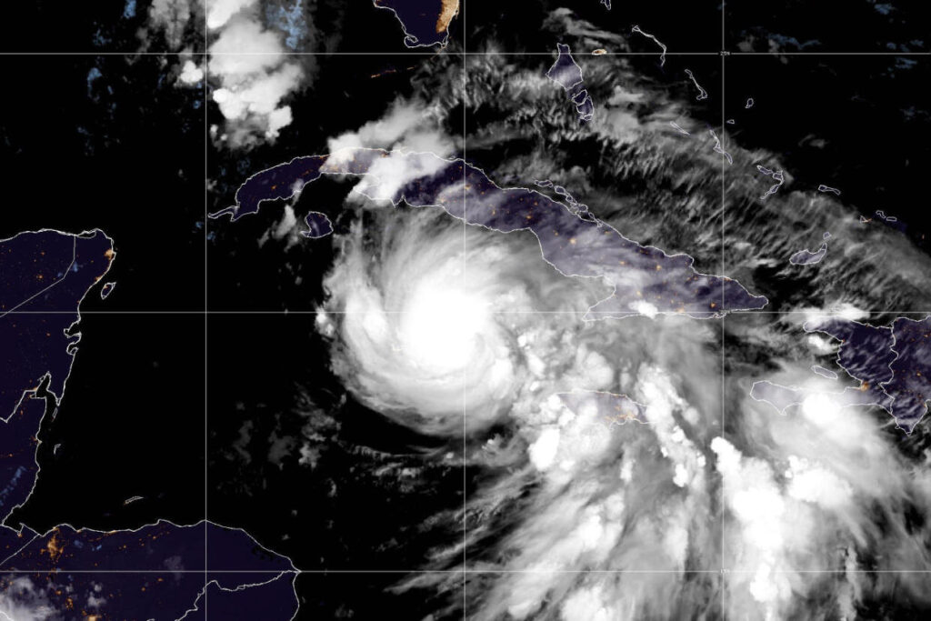
MIAMI — Tropical Storm Rafael is expected to strengthen and reach near “major hurricane strength” when it makes landfall in western Cuba, the National Hurricane Center said this morning.
In a 4 a.m. ET update, the NHC said Rafael was 195 miles south-south-east of Havana, with maximum sustained wind speeds of 90 mph, making it a Category 1 hurricane, and was moving northwest at 14 mph.
The hurricane could be approaching the U.S. Gulf Coast by Saturday and Sunday, according to the agency.
“Rafael could briefly weaken over Cuba but is then expected to emerge into the southeastern Gulf of Mexico as a hurricane,” the hurricane center said.
A hurricane warning was in effect Tuesday for the Cayman Islands and the Cuban provinces Pinar del Rio, Artemisa, Mayabeque, Matanzas and the Isle of Youth. Havana was also covered by the warning, which signals hurricane conditions, including destructive winds and flooding.
The government of the Cayman Islands issued a shelter-in-place advisory for Grand Cayman effective at 10 p.m. local time, according to a statement. “The public is advised to remain indoors and stay informed,” it said.
A shelter-in-place advisory was already in effect for the rest of the islands, the government said. Those in the Cayman Islands should expect damaging winds, torrential rain, a storm surge of up to 3 feet and wave heights of up to 15 feet, it said. People should stay away from the coastline, the government warned.
A storm surge of 6 to 9 feet along the southern coast of Cuba was possible overnight, federal forecasters said.
A tropical storm watch is in effect for the Cuban provinces of Camagüey and Las Tunas; meanwhile, a tropical storm warning is in effect Jamaica, for the lower and middle Florida Keys from Key West to west of the Channel 5 Bridge, and for the Dry Tortugas.
Rafael is forecast to move even farther westward as it continues its trek north over the next few days, with federal forecasters expecting it to be near or over western Cuba on Wednesday.
The storm will also bring heavy rain to the western Caribbean through early Thursday, including 3 to 6 inches across western Cuba. Isolated higher totals up to 10 inches are expected across the higher terrain in Jamaica and Cuba, “which could lead to areas of flash flooding and mudslides,” the hurricane center said.
Then heavy rain will spread north into Florida and adjacent areas of the Southeast U.S. by mid- to late week, with 1 to 3 inches of rain expected for the lower and middle Florida Keys.
The southwestern corner of Florida, including the Keys, could get tornadoes starting Wednesday morning and extending into Wednesday afternoon, Brennan said.
Forecasters were still uncertain about the storm’s path once inside the Gulf of Mexico, but said it was likely to weaken again amid the Gulf’s relatively cooler waters.
By MARLENE LENTHANG and DENNIS ROMERO/NBC News

