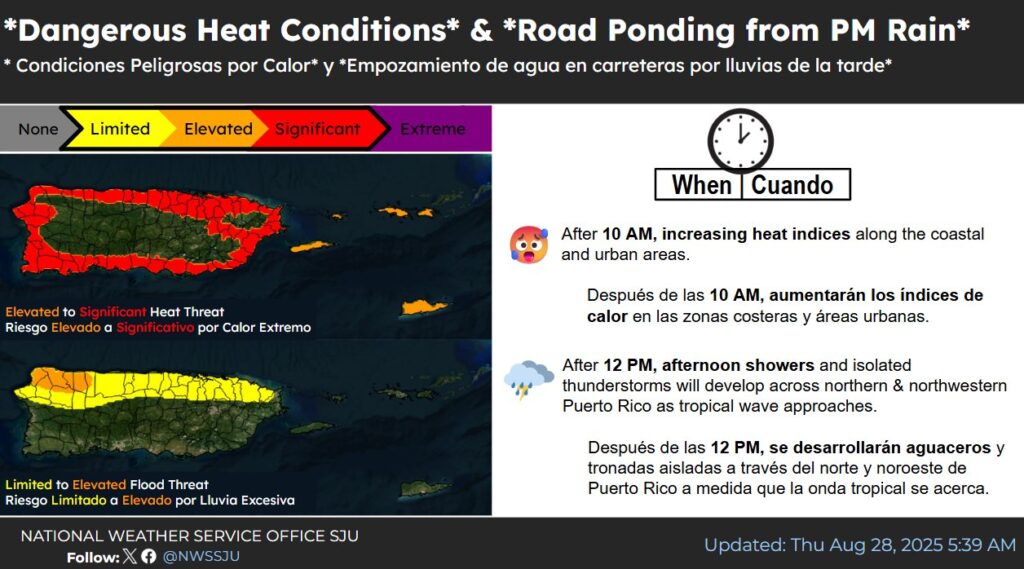
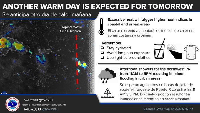
Dangerous heat conditions will continue through tomorrow, the National Weather Service said.
Afternoon showers may cause ponding on roads, according to the NWS.

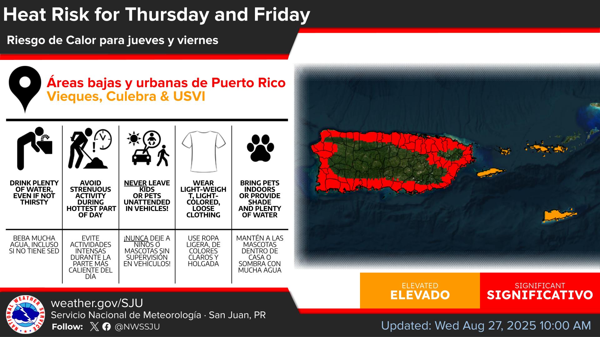
HEAT ADVISORY IN EFFECT from 10:00 a.m. to 5:00 p.m. today
* WHAT…This level of heat affect most individuals sensitive to heat, especially those without effective cooling and/or adequate hydration. Impacts possible in some health system and in heat-sensitive industries.
* WHERE…In the U.S. Virgin Islands, St Croix and St. Thomas, St. John and adjacent islands such as Water Island. In Puerto Rico, Culebra and Vieques.
* WHEN…From 10 AM this morning to 5 PM AST this afternoon.
* IMPACTS…Hot temperatures and high humidity may cause heat illnesses.
PRECAUTIONARY/PREPAREDNESS ACTIONS
Drink plenty of fluids, stay in an air-conditioned room, stay out of the sun, and check up on relatives and neighbors.

Hazardous Weather Outlook
This Hazardous Weather Outlook is for portions of U.S. Virgin Islands
DAY ONE (Today and Tonight)
* Lightning…Isolated thunderstorms, particularly across the USVI. Stay alert and be prepared to take shelter if storms develop.
* Excessive Heat…This level of heat affects primarily individuals sensitive to heat, especially those without effective cooling and/or adequate hydration. Those extremely sensitive to heat face the highest risk. Some health systems and heat-sensitive industries could be affected.
* Rip Currents…Life-threatening rip currents are possible in the surf zone, particularly across easternmost St. Croix. Isolated stronger rip currents may occur elsewhere, especially near piers, jetties, and channels.

DAYS TWO THROUGH SEVEN (Friday through Wednesday)
Excessive heat will remain the primary concern throughout the period, while the risk of ponding of water will persist each day (particularly during the afternoons). Heat risks can be up to elevated. Low marine and coastal risks are forecast.
Marine Weather Statement
THUNDERSTORMS DUE TO A TROPICAL WAVE WILL AFFECT THE CARIBBEAN OFFSHORE WATERS AND ANEGADA PASSAGE
The areas affected include…
Anegada Passage east of Virgin Gorda and Saint Croix south to 17N…
Caribbean Waters of Puerto Rico from 10 NM to 17N, including the
Coastal Waters of Saint Croix…
Mona Passage Southward to 17N…
At 612 AM AST, Doppler radar indicated a strong thunderstorm, capable of producing winds to around 30 knots. These thunderstorms are spreading into the local Caribbean Offshore waters and Anegada Passage, moving northwest at 10 knots.
PRECAUTIONARY/PREPAREDNESS ACTIONS
Mariners can expect gusty winds to around 30 knots, locally higher waves, and lightning strikes. Boaters should seek safe harbor immediately until this storm passes.