Hazardous Weather Outlook
![]()
![]()

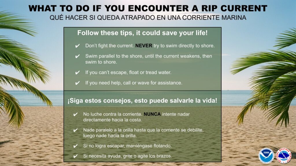
Dangerous rip currents through this afternoon along the western, northern, and eastern beaches of Puerto Rico, Culebra, and Saint Thomas.
![]()
![]()
From the National Weather Service San Juan Puerto Rico at 529 AM AST Wednesday August 27, 2025
For St. Thomas, St. John adjacent Islands such as St Croix nearshore Atlantic and adjacent Caribbean coastal waters.
This Hazardous Weather Outlook is for portions of U.S. Virgin Islands.
DAY ONE (Today and Tonight)
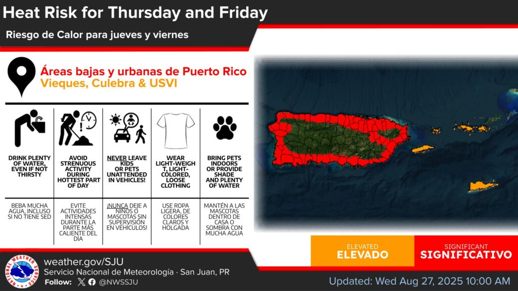
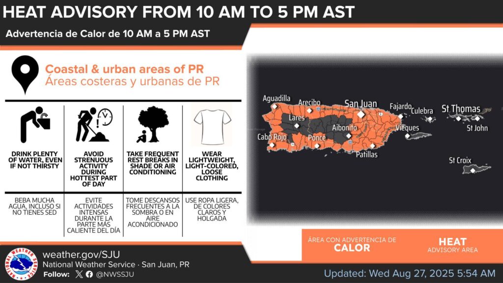
Excessive Heat…This level of heat affects primarily those individuals extremely sensitive to heat, especially when outdoors without effective cooling and/or adequate hydration.
Marine Conditions…Small craft should exercise caution, particularly across the offshore Atlantic.
Rip Currents…Life-threatening rip currents are likely in the surf zone, particularly across St. Thomas and St. John.
These life- threatening conditions are possible across St. Croix with isolated stronger rip currents possible elsewhere, especially near piers, jetties and channels.
DAYS TWO THROUGH SEVEN (Thursday through Tuesday)
Excessive heat will remain the primary concern throughout the period (particularly on Thursday and Friday).
The risk of ponding of water and lightning strikes will persist each day and may increase with the influence of an approaching upper-level trough.
Moisture from a nearby tropical wave through the workweek. A moderate rip current risk is then expected to continue through Thursday afternoon.