![]()
![]()
![]()
![]()
![]()
![]()


![]()
![]()
![]()
![]()
![]()
![]()
![]()
![]()
![]()
![]()
![]()
![]()
![]()
![]()
![]()
![]()
US️![]()
Hazardous Weather Outlook from the National Weather Service in San Juan, Puerto Rico at 401 a.m. Atlantic Standard Time (AST) on Saturday, August 23, 2025
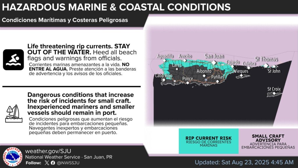
St. Thomas, St. John and adjacent Islands such as St Croix nearshore Atlantic and adjacent Caribbean coastal waters.
This Hazardous Weather Outlook is for portions of U.S. Virgin Islands.
DAY ONE (Today and Tonight)
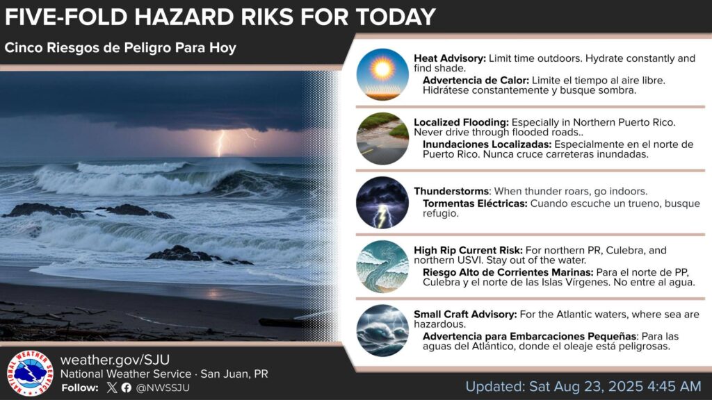
* Lightning…Isolated thunderstorms throughout the day. Stay alert and be prepared to take shelter if storms develop.
* Excessive Rainfall…Ponding of water in roads and poorly drained areas. There is a low chance of localized urban and small streams flooding.
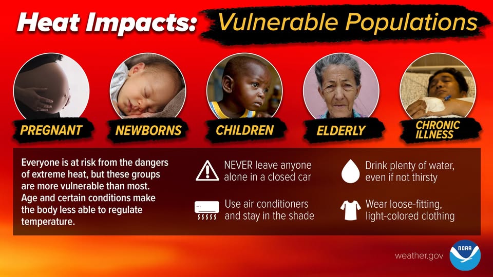
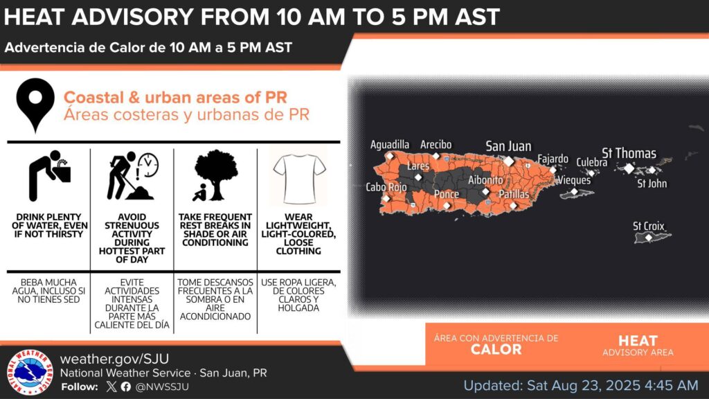
* Excessive Heat…This level of heat affects primarily those individuals extremely sensitive to heat, especially when outdoors without effective cooling and/or adequate hydration.
* Marine Conditions…Small craft should exercise caution.
* Rip Currents…Life-threatening rip currents are likely in the surf zone, particularly across St Thomas and St John. Isolated stronger rip currents may occur elsewhere, especially near piers, jetties, and channels.
DAYS TWO THROUGH SEVEN (Sunday through Friday)
The risk of excessive heat will persist throughout the workweek.
Swells from former Hurricane Erin will maintain hazardous marine conditions and a high risk of life-threatening rip currents through midweek.
These will be exacerbated by breezy winds, particularly on Sunday and Monday.
Additionally, a plume of the Saharan Air Layer (SAL) will move in from Sunday through Tuesday, resulting in hazy skies, reduced visibility, and deteriorating air quality.