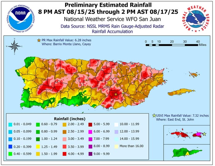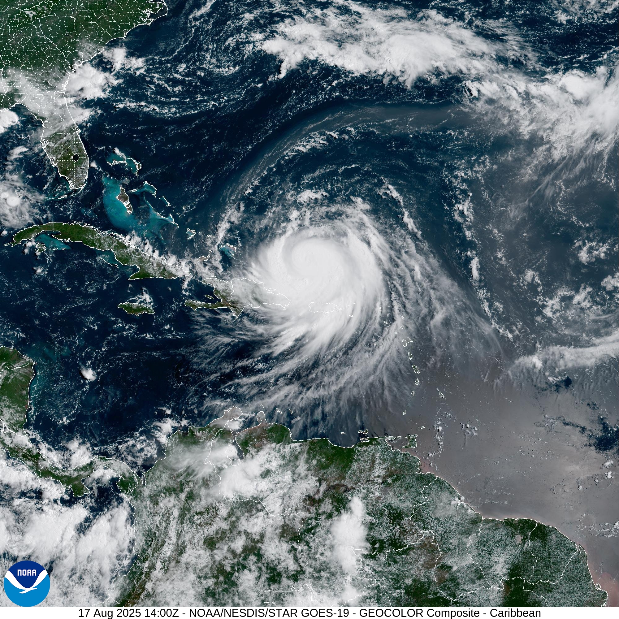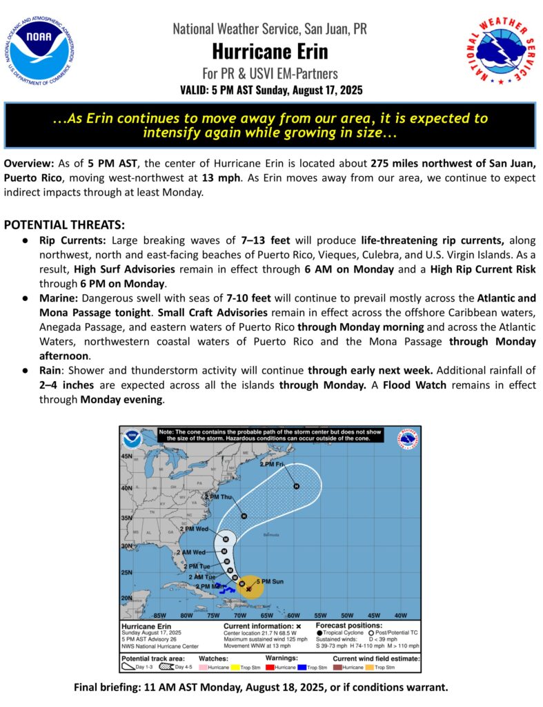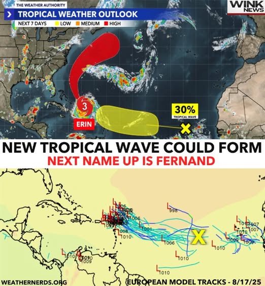
CHRISTIANSTED — Hurricane Erin’s outer rainbands continued producing gusty winds and heavy rainfall across the U.S. Virgin Islands and Puerto Rico today, the National Weather Service said.


![]()
![]()
![]()
![]()
![]()
![]()
![]()
![]()
#PRwx#USVIwx#HurricaneSeason#StayPrepared ·
The NWS in San Juan has issued a * Special Marine Warning for…Anegada Passage east of Virgin Gorda and Saint Croix south to 17N…Caribbean Waters of Puerto Rico from 10 NM to 17N, including the Coastal Waters of Saint Croix…Coastal Waters east of Puerto Rico, around Vieques, and around and just north of Culebra and Saint John…Coastal Waters from Cabo San Juan to the waters between Anegada Island and Virgin Gorda and North 10 NM…Coastal Waters of Southern Puerto Rico out 10 NM…until 7:45 a.m. today.

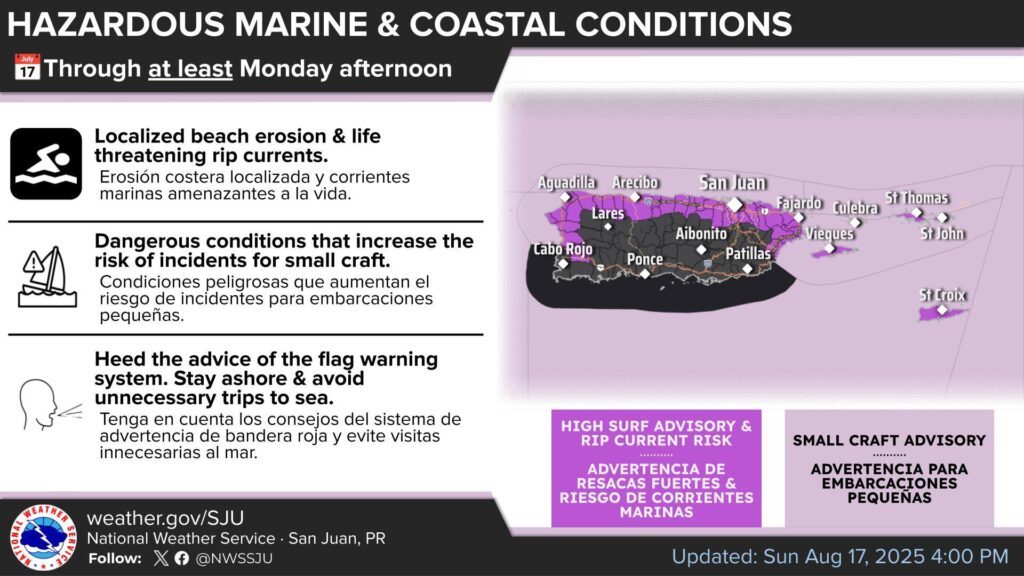
Marine and coastal conditions
- High Surf Advisory through Monday morning (large breaking waves 7-13 feet)
- High Rip Current Risk through Monday afternoon.
- Small Craft Advisories through at least Monday afternoon (Seas 7-10 feet).
Tonight: Breezy. Mostly cloudy with numerous showers with isolated thunderstorms. Lows around 82. South winds 15 to 20 mph with gusts up to 25 mph. Chance of rain 60 percent.
Tomorrow: Breezy. Mostly cloudy with scattered showers with isolated thunderstorms. Highs around 90. Temperature falling in the afternoon. South winds 15 to 20 mph with gusts up to 25 mph. Chance of rain 50 percent.