


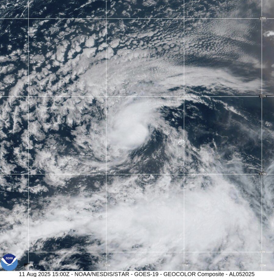
MIAMI — Tropical Storm Erin formed in the Atlantic Monday morning, and it’s one that forecasters say bears watching — especially for the Caribbean and Florida.
The National Hurricane Center’s initial forecast track for the fifth named storm of the season shows it headed west across the Atlantic for the next several days. Forecasters are predicting Erin will be the season’s first hurricane and first major hurricane, potentially reaching Category 3 by Saturday.
The hurricane center’s forecast only goes out to Saturday, but longer-range global weather models have continued to suggest the system could curve north around that time.

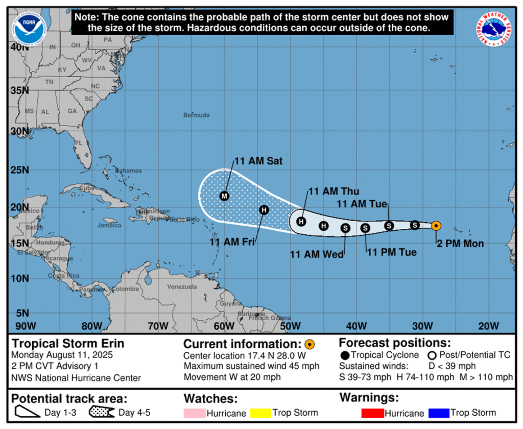
“It should be noted that spread in the track guidance, especially the ensembles, begins to increase markedly at the end of the forecast period,” NHC forecasters wrote in the 11 a.m. discussion.
As of this morning, Erin is very far from the Caribbean or the U.S., thousands of miles away.
“For the system to directly threaten Florida it would have to move nearly straight west for days & days. The odds of that are low but not zero,” Craig Setzer, meteorologist for Royal Caribbean Group, posted on X Monday.

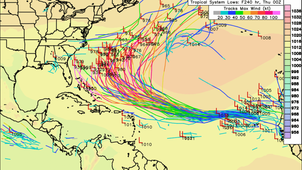
For now, long-range computer models appear split on the fate of the disturbance. Nearly all of them show it moving steadily west and gaining steam for the next few days, but then they split. Many curve the would-be storm north, toward Bermuda and away from the Caribbean. Others show a storm continuing due west and headed toward the Caribbean and U.S.
“The Bahamas and East Coast should continue to keep an eye on things in case it takes the left edge of the ensemble suite,” Andy Hazelton, an associate scientist at the University of Miami, posted X Monday. Should the storm reach American shores, it likely wouldn’t happen until sometime mid to late next week. Were it to head to the Caribbean, the storm could arrive in that area sooner. The hurricane center is also watching two other disturbances in the central and northwestern Atlantic. Both have just a 10% chance of developing in the next two to seven days. Neither pose a threat to land anytime soon.
Tropical Storm Erin formed in the Atlantic Ocean west of the Cabo Verde Islands this morning.

It is currently the fifth named storm of the 2025 Atlantic hurricane season.
The storm is moving westward and is expected to intensify, potentially becoming a major hurricane within five days, though it is currently not a threat to the U.S. Virgin Islands or Puerto Rico.
Forecasters are closely monitoring its progress and potential impact on land as it tracks westward.

Tropical Storm Erin today
