


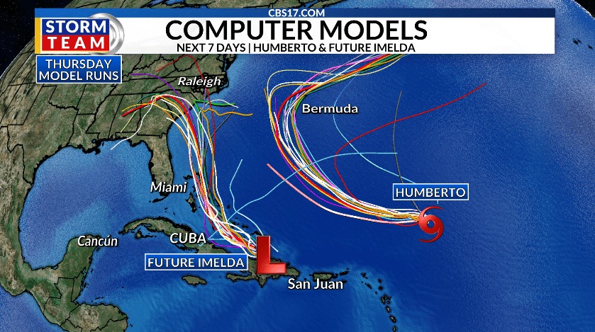
Hurricane Humberto, now a Category 1 storm, could become a major hurricane today or tomorrow, the National Hurricane Center said.
According to an 11 a.m. ET advisory on Friday, Sept. 26, by the National Hurricane Center in Miami, the storm is spinning around 450 miles northeast of the northern Leeward Islands in the Caribbean, with maximum sustained winds of 90 mph.
The storm is moving northwest at 5 mph and is expected to intensify into a major hurricane, according to the National Hurricane Center. A storm becomes a major hurricane when its wind speeds exceed 110 mph and is considered to be a Category 3 hurricane or higher.
As of this morning, there are no coastal watches or warnings in effect related to Hurricane Humberto.

Gabrielle becomes a post-tropical cyclone
According to the National Hurricane Center, the center of Gabrielle is moving away from the Azores, an autonomous region of Portugal in the mid-Atlantic. It has dissipated into a post-tropical cyclone with maximum sustained winds of 65 mph.
Winds will continue to weaken later in the afternoon, while flooding across the high terrain in the Central Azores is also expected to subside.

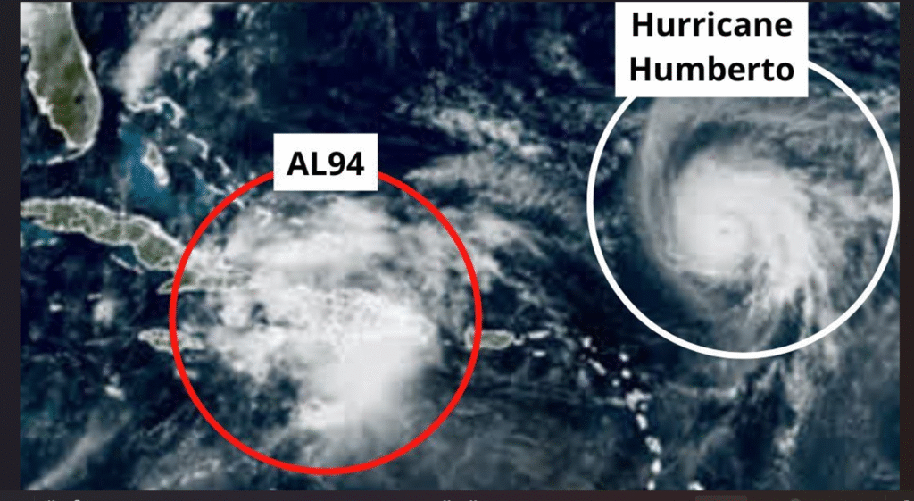
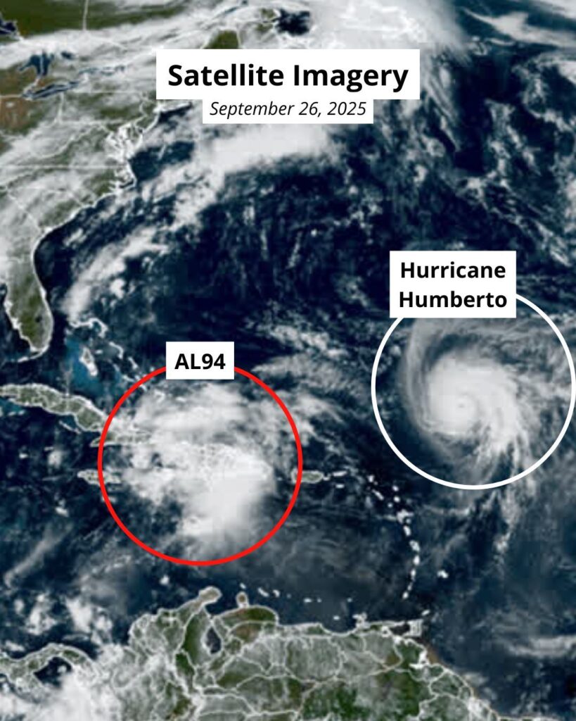
NHC tracking one more system in the Atlantic
Humberto is not the only storm in the Atlantic Ocean, according to the NHC.
Invest 94L, a tropical wave moving in the Caribbean Sea, is likely to become the next named storm, Tropical Storm Imelda, by the weekend as it moves into the Bahamas, and it’s increasing the likelihood of potential impacts along the U.S. coast, according to the National Hurricane Center.
The storm has already brought “heavy rains and gusty winds” to the Dominican Republic, Haiti and the Turks and Caicos Islands. The storm is expected to reach the Bahamas and eastern Cuba within the next couple of days.
Invest 94L has a 90% chance of formation in the next 48 hours and a 90% chance of formation in the next 7 days, according to the NHC.
