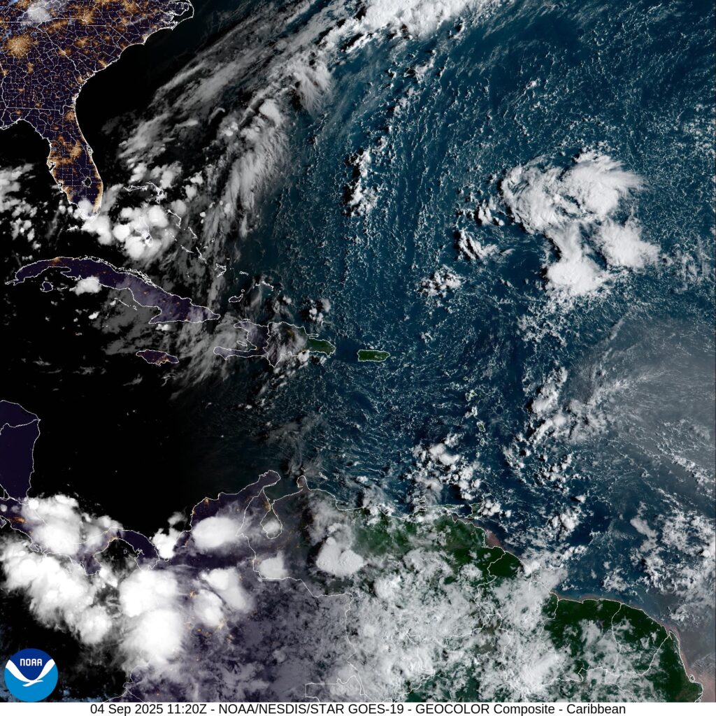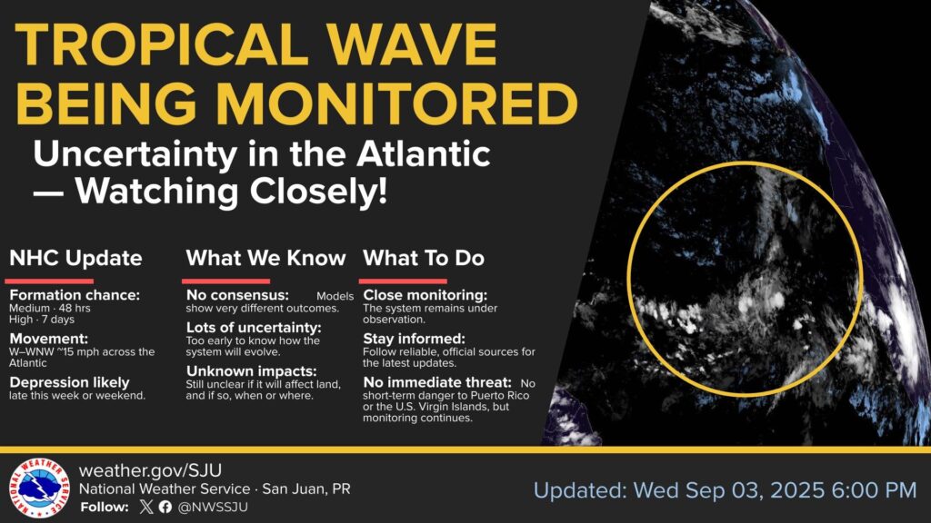

A wave in the eastern tropical Atlantic Ocean is being monitored by the National Hurricane Center but currently poses no threat to land.
Showers and thunderstorms associated with this tropical wave are located several hundred miles west-southwest of the Cabo Verde Islands have become a little more concentrated during the past several hours.
Environmental conditions are conducive for development of this system during the next several days, and a tropical depression is likely to form late this week or this weekend over the eastern or central tropical
Atlantic while moving slowly toward the west-northwest at 5 to 10 mph.
The system is likely to move faster toward the west or west-northwest thereafter and reach the waters east of the Lesser Antilles by the middle of next week.

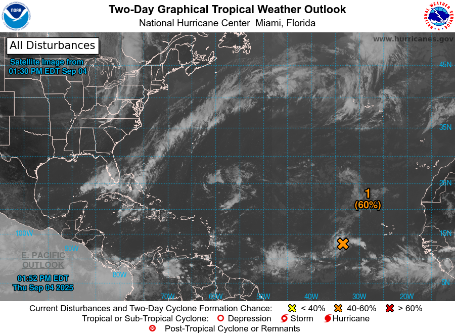
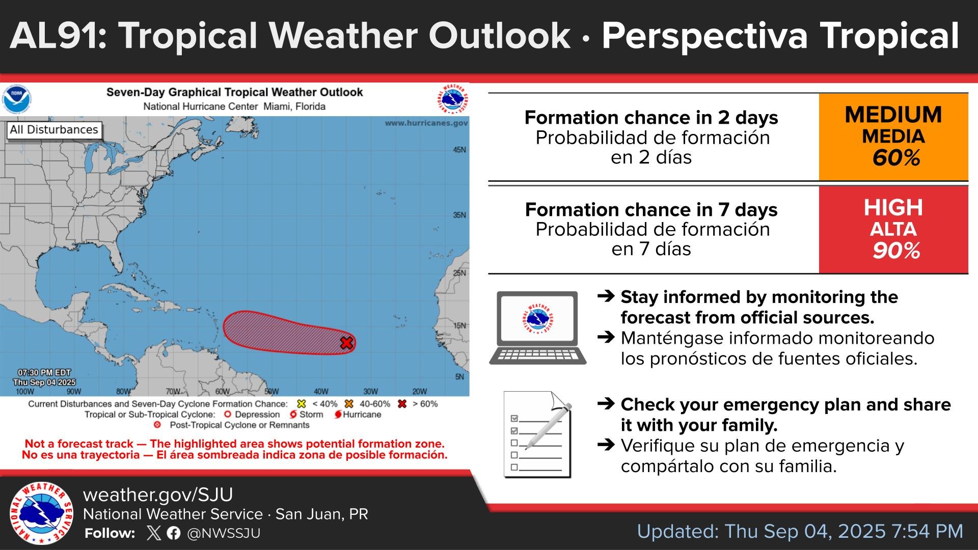
* Formation chance through 48 hours…medium…40 percent.
* Formation chance through 7 days…high…80 percent.
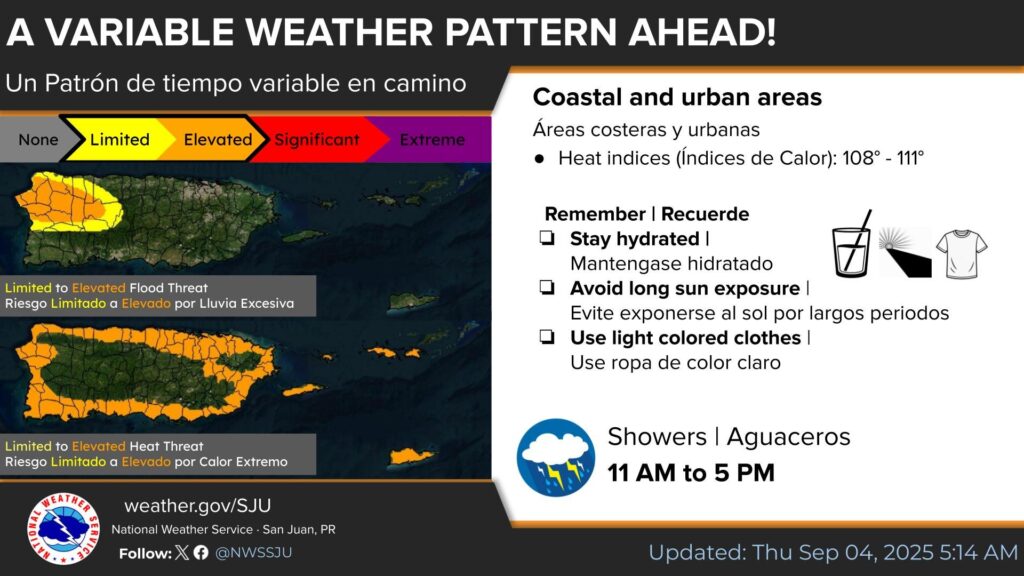
HEAT ADVISORY IN EFFECT FROM 10 AM THIS MORNING TO 5 PM AST THIS AFTERNOON.
* WHAT…This level of heat affect most individuals sensitive to heat, especially those without effective cooling and/or adequate hydration. Impacts possible in some health system and in heat-sensitive industries.
* WHERE…Portions of the Virgin Islands and Puerto RIco.
* WHEN….From 10 AM this morning to 5 PM AST this afternoon.
* IMPACTS…Hot temperatures and high humidity may cause heat illnesses.
PRECAUTIONARY/PREPAREDNESS ACTIONS…
- Drink plenty of fluids, stay in an air-conditioned room, stay out of the sun, and check up on relatives and neighbors.
- Take extra precautions when outside. Wear lightweight and loose fitting clothing.
- Try to limit strenuous activities to early morning or evening.
- Take action when you see symptoms of heat exhaustion and heat stroke.
- To reduce risk during outdoor work, the Occupational Safety and Health Administration recommends scheduling frequent rest breaks in shaded or air conditioned environments.
Anyone overcome by heat should be moved to a cool and shaded location. Heat stroke is an emergency! Call 9 1 1.