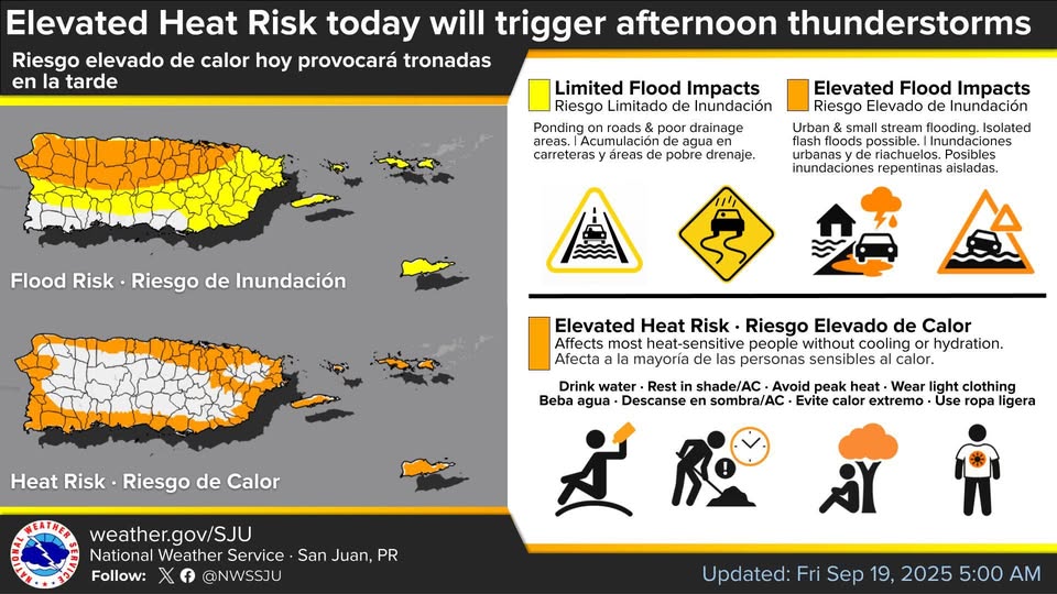
There is an elevated Heat Risk today which will trigger afternoon thunderstorms, the National Weather Service said.
The heat will affect people who are heat-sensitive and without cooling or hydration, according to the NWS.

HEAT ADVISORY IN EFFECT FROM 10 AM THIS MORNING TO 5 PM AST THIS AFTERNOON
* WHAT...This level of heat affect most individuals sensitive to heat, especially those without effective cooling and/or adequate hydration. Impacts possible in some health system and in heat-sensitive industries.
* WHERE…All urban and coastal areas, as well as the eastern interior, Vieques, Culebra in Puerto Rico, and all of the U.S. Virgin Islands.
* WHEN…From 10 AM this morning to 5 PM AST this afternoon.
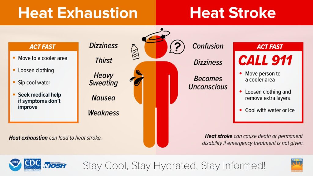
* IMPACTS…Hot temperatures and high humidity may cause heat illnesses.

PRECAUTIONARY/PREPAREDNESS ACTIONS
Drink plenty of fluids, stay in an air-conditioned room, stay out of the sun, and check up on relatives and neighbors.
Monitor the latest forecasts and warnings for updates.
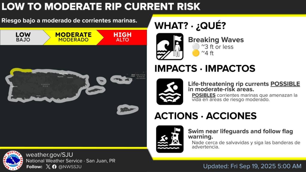
Moderate Rip Current risk northwestern Puerto Rico
There is a flood risk: from ponding on roads to localized urban and stream flooding with isolated flash floods possible.
A moderate risk will return tomorrow across most north exposed beaches of the islands.

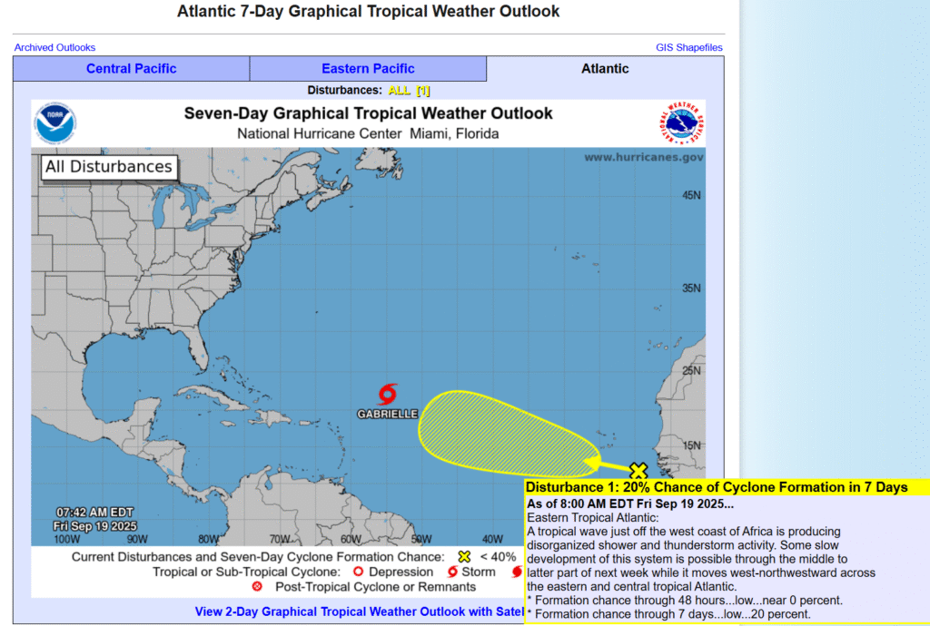
Active systems
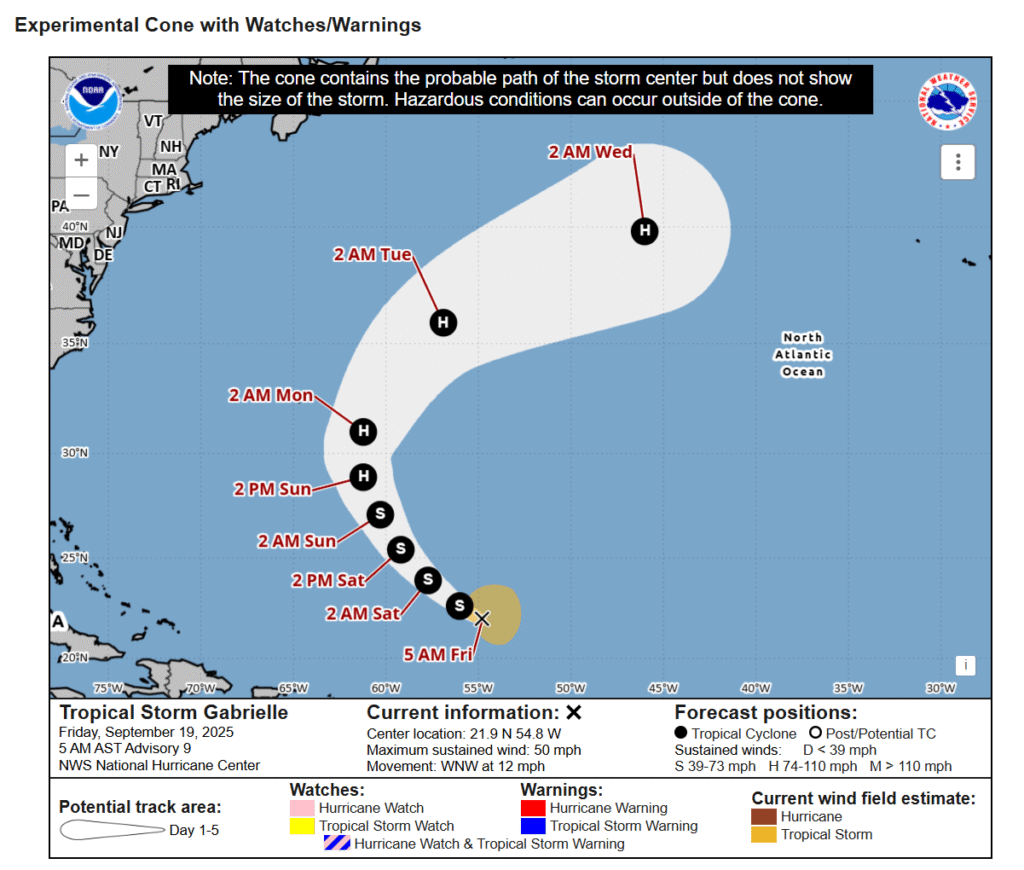
The National Hurricane Center is issuing advisories on Tropical Storm Gabrielle, located in the central tropical Atlantic.

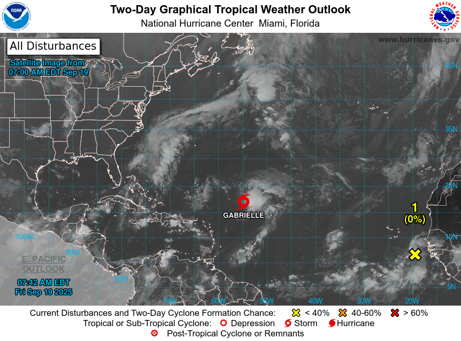
Eastern tropical Atlantic
A tropical wave just off the west coast of Africa is producing disorganized shower and thunderstorm activity.
Some slow development of this system is possible through the middle to latter part of next week while it moves west-northwestward across the eastern and central tropical Atlantic.
* Formation chance through 48 hours…low…near 0 percent.
* Formation chance through the next seven days…low…20 percent.
https://www.youtube.com/watch?v=ga29O5u0li8