Site icon Virgin Islands Free Press

Tropical wave Invest 98-L forecast

[October 19] Tropical Wave Invest 98-L

Associated moisture will bring showers and possible thunderstorms , mainly across the U.S. Virgin Islands and east-southeast Puerto Rico tonight and tomorrow.

Weโ€™re monitoring tropical wave (Invest 98-L) far out in the Atlantic.

This system is NOT currently a threat to the U.S. Virgin Islands and Puerto Rico.

Forecasters will watch it next week as it moves into the Caribbean.

The best action is to stay informed with official sources like NWS San Juan.

Enjoy your weekend!

Stay hydrated and stay out of rough seas!

ย Showers & a few storms moving inland tonight = LIMITED Flood & Lightning Risk for E-PR & USVI.

ย Minor ponding possible

ย Isolated lightning at night โ€” most are home, but stay indoors if thunder!

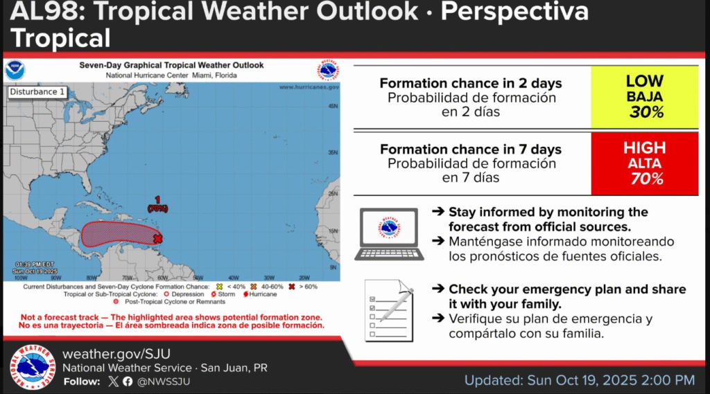
8 AM AST Tropical Weather Outlook

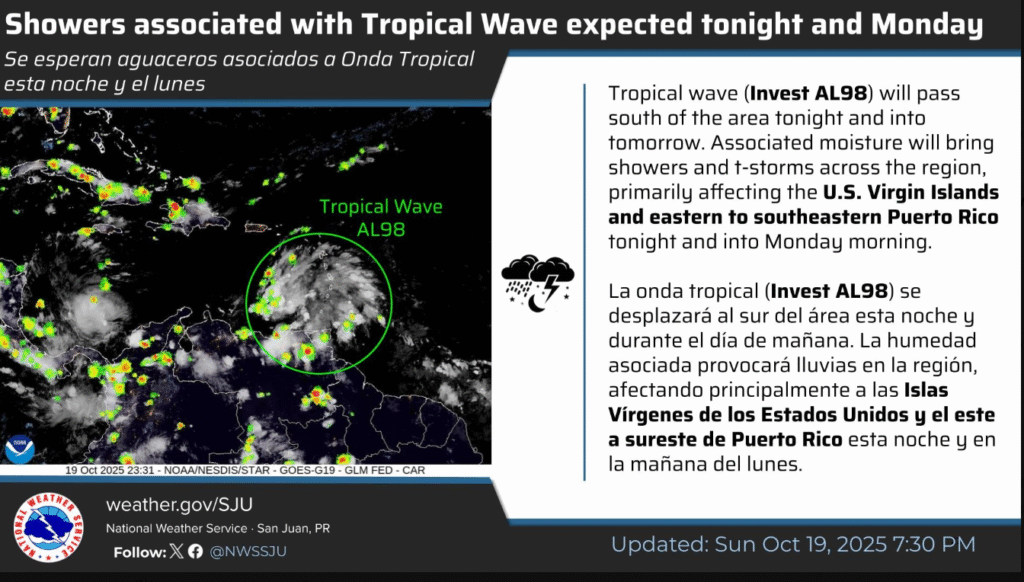
Tropical Wave AL98 located near the Windward Islands is producing a large area of showers and thunderstorms as it moves westward at 20 โ€“ 25 mph.

The system is expected move across the Caribbean Sea in next days and could become a tropical depression by the middle to latter part of the week.

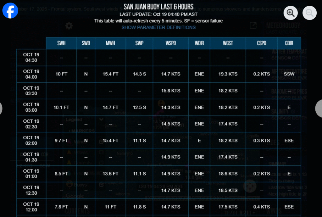
A northerly swell spreading across the regional waters will continue to promote hazardous marine and coastal condition through at least Tuesday.

Residents and visitors should stay off the water and follow beach flag warnings.

Stay informed via hurricanes.gov and weather.gov/sju.

#PRwx #usviwx

Exit mobile version