


By V.I. Free Press Staff
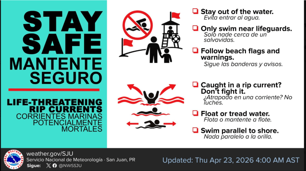
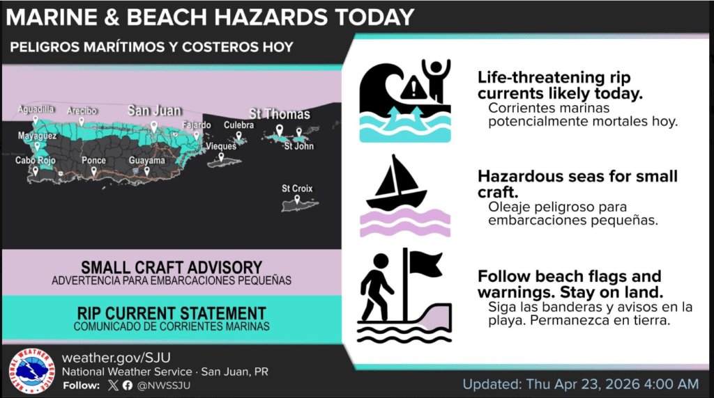
The National Weather Service in San Juan has issued a high-risk advisory for life-threatening rip currents effective today, Thursday, April 23. A powerful northerly swell is currently impacting the region, creating treacherous conditions specifically along north-facing beaches.
Authorities are urging residents and visitors to stay out of the water today. If you find yourself caught in a rip current, the primary rule is: Do not fight it. Float or tread water, and swim parallel to the shore until you are out of the pull. Small craft operators should also remain vigilant, as a Small Craft Advisory remains in effect due to hazardous sea conditions. While the risk is expected to lower to “moderate” by tomorrow, the shoreline remains a zone of high caution for the immediate future.
Heat Wave Brewing for the Weekend
Looking past the surf, a significant warming trend is developing. Starting Sunday and lasting into mid-week, a southerly wind flow will pull a plume of deep moisture from the Caribbean across the islands. This combination will push heat indices near or above 100°F. Residents are encouraged to prioritize hydration and limit sun exposure as these warmer-than-normal conditions take hold.
The Pilot’s Log: Aviation Weather Briefing
In our new “Hangar Talk” sidebar, we break down the technical reports for the pilots and commuters moving through Caribbean airspace today.
- Operational Status: Visual Flight Rules (VFR) will prevail today across the islands, indicating high visibility and clear ceilings for most flight paths.
- Local Conditions (TISX): At Henry E. Rohlsen Airport in St. Croix, light and variable winds this morning will transition to an East-North-East flow at 8–12 knots this afternoon, with potential gusts reaching 20 knots.
- Regional Watch: Pilots heading toward Ponce (TJPS) should watch for brief marginal visibility (MVFR) this afternoon due to localized interior showers.
Aviation Glossary:
- TISX: ICAO code for Henry E. Rohlsen Airport, St. Croix.
- VCSH: Showers in the vicinity; rain is nearby but not impacting the runway.
- LGT/VRB: Light and variable winds, often seen during morning transitions.