

By V.I. Free Press Staff
ST. CROIX — Residents across the U.S. Virgin Islands should prepare for a “split” weather Sunday—starting with a relatively quiet morning followed by increasing heat and isolated thunderstorms this afternoon.
According to the latest National Weather Service (NWS) San Juan advisory issued at 4:00 AM AST, a transition toward a much wetter and more unstable weather pattern is expected to settle in by Monday and Tuesday.
Today’s Outlook: Sunday, April 26
The morning hours remain largely calm, but conditions will shift as the day progresses:
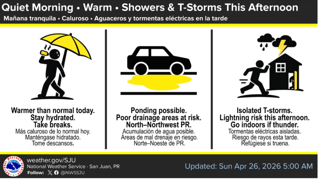
- Afternoon Storms: Isolated to scattered showers and thunderstorms are expected to increase this afternoon. While many areas will see limited activity today, any developing storms will move slowly, potentially leading to localized ponding of water on roadways.
- Intense Heat: Above-normal temperatures persist. With the wind pulling from the east-southeast, humidity levels are rising. Heat indices (how it feels) could reach or exceed 100°F, particularly in coastal and urban areas.
- Winds: Expect light to gentle breezes (up to 10 mph) shifting from the southeast.
The Week Ahead: A “Wetter” Tuesday
Forecasters are tracking a surface trough and a mid-to-upper-level trough that will bring deep Caribbean moisture into the region by midweek:
- Monday & Tuesday: The risk of flooding shifts from “limited” to “elevated.” Periods of heavy rainfall and frequent lightning are expected as a moist, unstable pattern takes hold.
- Wednesday – Friday: Unsettled conditions will persist through the end of the workweek, with daily rounds of showers and thunderstorms likely.
Marine & Beach Safety
While seas remain below Small Craft Advisory criteria, beachgoers should remain vigilant:
- Rip Current Risk: A Moderate Risk of rip currents remains in effect for north- and east-facing beaches of St. Croix, St. Thomas, and St. John.
- Swell Activity: Small, long-period NNE swells continue to affect Atlantic waters, which can create life-threatening conditions even in seemingly calm surf.
- Boaters: Light to moderate southerly winds will prevail today, turning more east-southeasterly by midweek.

NWS Safety Recommendations
- Stay Hydrated: Drink plenty of water and take frequent breaks if working or spending time outdoors.
- Lightning Safety: If you hear thunder, head indoors immediately.
- Road Safety: Do not attempt to drive through flooded roads or areas of significant ponding.
Even as the clouds gather, the island’s pace remains steady—perhaps a bit more predictable than the flight path of a Gulfstream heading toward a private hangar. Stay cool and keep an eye on the sky.
Updated: April 26, 2026 | 5:00 AM AST Source: National Weather Service, San Juan PR