


By JOHN McCARTHY / V.I. Free Press News Reporter
ST. CROIX — The dog days of summer are officially here, bringing a mix of hazy Saharan skies, oppressive heat, and the first signs of tropical activity in the Atlantic. While tracking these far-off weather systems from orbit is a seamless task for NOAA’s advanced satellites—and perhaps eventually Elon Musk’s ever-expanding Starlink network—local residents only need to look outside to see that the tropical Atlantic is finally waking up.
Here is the complete, professional breakdown of what to expect over the next several days across St. Croix and the wider U.S. Virgin Islands, compiled from the latest National Weather Service (NWS) San Juan and National Hurricane Center (NHC) briefings.

1. The Immediate Outlook: Saharan Dust & Heat (Wednesday)
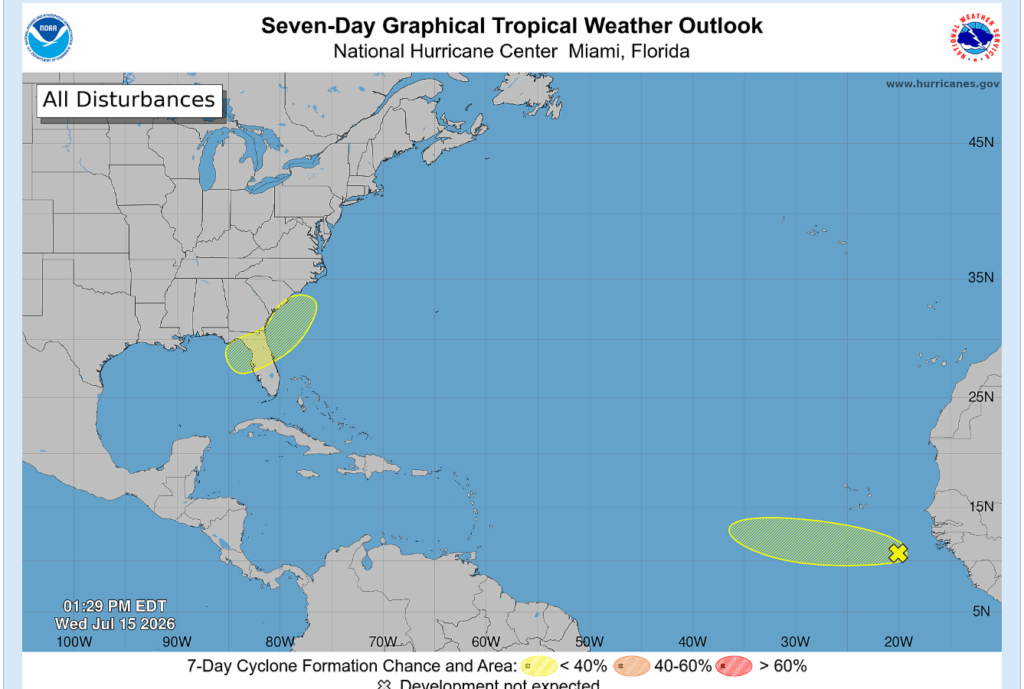
- The Haze: Moderate concentrations of Saharan dust will continue to blanket the Virgin Islands today, keeping skies hazy and limiting visibility. However, the dust is forecast to gradually thin out by early Thursday morning.
- The Heat: Expect a limited heat risk today. Because moisture levels are relatively low, peak heat indices are generally forecast to stay under 108 degrees. However, localized and low-wind areas on St. Croix could briefly see heat index values spike to 108 degrees during peak afternoon hours.
- Fire Danger Warning: Extremely dry soils, combined with breezy easterly winds of 10 to 15 mph and relative humidity dropping into the 40s and 50s, have triggered an elevated fire danger risk across the region. Any brush fires that ignite today could spread rapidly.

2. The Mid-Week Shift: Incoming Rain (Thursday & Friday)
- Thursday’s Wet Weather: Expect a noticeable change tomorrow. An approaching surface disturbance and upper-level instability will drag a surge of moisture over the islands. This will trigger frequent passing morning showers across the USVI and eastern Puerto Rico, followed by scattered afternoon thunderstorms.
- Friday’s Drying Trend: The wet weather will be short-lived. Dry air returns rapidly on Friday, quickly dropping rain chances.
- Elevated Friday Heat: As a high-pressure system builds back in, easterly winds will turn breezy and low-level temperatures will spike. The combination of returning sunshine, dry air, and strong breezes will elevate the heat risk to end the workweek.

3. The Long-Term & Weekend Outlook
- The Weekend: Typical summer weather dominates Saturday, with mostly dry conditions across the USVI and only isolated afternoon showers over western Puerto Rico.
- Early Next Week (Sunday–Tuesday): A weak, upper-level atmospheric trough is forecast to move into the area. This will weaken the local high-pressure ridge and increase atmospheric instability. Expect afternoon and evening thunderstorms to increase from Sunday through Tuesday, with Monday and Tuesday carrying the highest probability of widespread rainfall and localized street ponding.
4. Marine and Beach Hazards
- Rip Currents: The risk of life-threatening rip currents is currently low across all USVI beaches today. However, beginning Thursday, strengthening east-southeast winds will raise the rip current risk to moderate along the north, east, and southeast-facing beaches of St. Croix, St. Thomas, and St. John. This moderate risk is expected to persist through the weekend.
- Boating Conditions: A tight pressure gradient will support moderate to fresh easterly winds, creating choppy, moderate seas through much of the week. Hazy conditions will also temporarily reduce visibility for local mariners today.
5. Tropical Atlantic Watch (NHC Update)
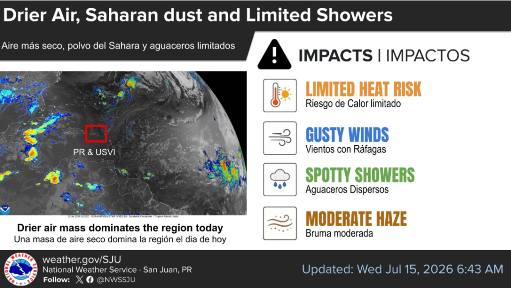
The National Hurricane Center in Miami is officially monitoring two areas of interest in its latest seven-day outlook:
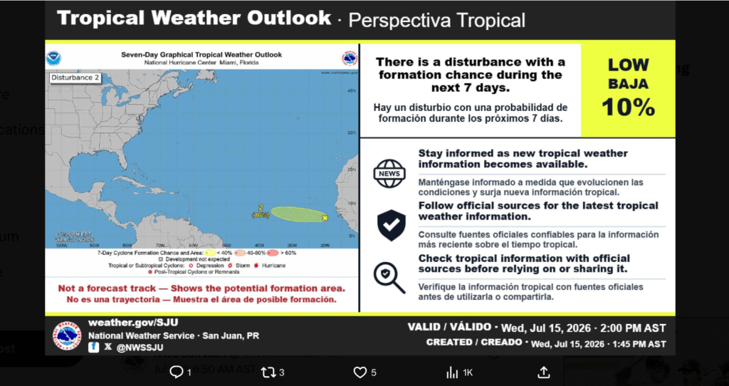
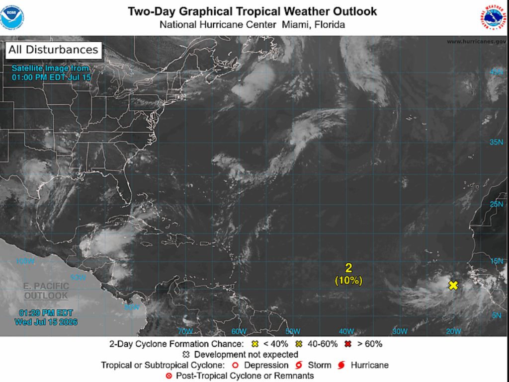
- Disturbance 2 (Eastern Atlantic): A tropical wave located near the west coast of Africa (around 20W longitude) is moving westward. The NHC has designated this wave with a LOW (10 percent) chance of development over both the next 48 hours and the next 7 days. It poses no immediate threat to the Caribbean.
- Disturbance 1 (Southeastern US Coast): A localized area of low pressure stretching across the Florida peninsula and Georgia coast is also being monitored with a LOW (under 40 percent) chance of development over the next 7 days as it drifts northeastward into the Atlantic.