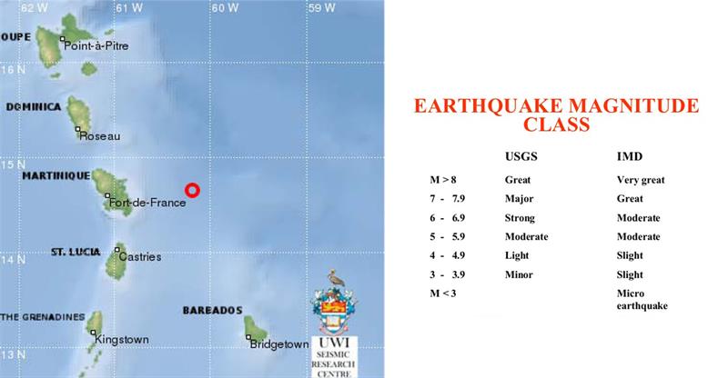
CASTRIES — The National Emergency Management Organization (NEMO) has received information from the University of the West Indies Seismic Research Center, Trinidad, indicating that that there was a 3.7 magnitude earthquake about 70 miles north east of St. Lucia’s capital city at 9:32 p.m., on Jan. 22.
The earthquake occurred at latitude 14.65 north and 60.19 west at a depth of 6.2 miles.
Earthquakes with a magnitude measuring between 2.5 to 5.4 are often felt but only cause minor damage.
Also there was a magnitude 3.6 earthquake occurred on Jan. 21 about 33 miles from San Pedro de Macoris in the Dominican Republic, according to the U.S. Geological Survey (USGS).
There are about 30,000 each year.
A 3.7 magnitude earthquake is categorized as minor.


Thanks for picking up on this John. You can add these 34+ quakes to the list of 30 others in the past 30 days around PR and VI. There has been a total of 142 quakes in the area over that time frame. Little quakes cause/lead to bigger quakes. What is concerning Mapp has not addressed the plan or the downed horns in any recent speech. He is clueless and the people are in danger. See the USGS site and click latest earthquakes and last 30 days for PR area.
https://earthquake.usgs.gov/earthquakes/map/#%7B%22autoUpdate%22%3A%5B%22autoUpdate%22%5D%2C%22basemap%22%3A%22grayscale%22%2C%22feed%22%3A%2230day_m25%22%2C%22listFormat%22%3A%22default%22%2C%22mapposition%22%3A%5B%5B14.902321826141808%2C-71.268310546875%5D%2C%5B21.074248926792812%2C-60.72143554687499%5D%5D%2C%22overlays%22%3A%5B%22plates%22%5D%2C%22restrictListToMap%22%3A%5B%22restrictListToMap%22%5D%2C%22search%22%3Anull%2C%22sort%22%3A%22newest%22%2C%22timezone%22%3A%22utc%22%2C%22viewModes%22%3A%5B%22list%22%2C%22map%22%2C%22settings%22%5D%2C%22event%22%3Anull%7D