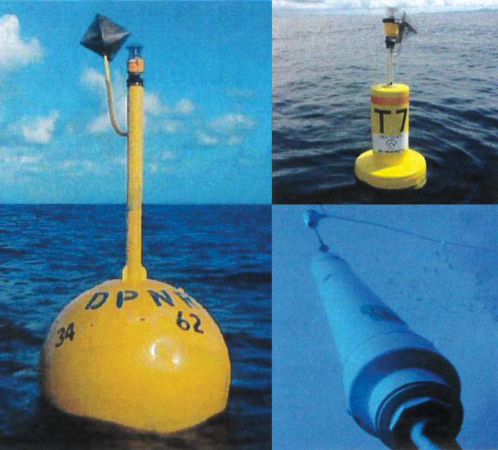
CHARLOTTE AMALIE — The Virgin Islands Department of Planning and Natural Resources has deployed three new fish-aggregating devices, DPNR Commissioner Jean-Pierre Oriol said.
The devices consist of a yellow surface buoy with a radar reflector and flashing light to help vessels navigate around it. Mooring vessels to the devices is prohibited as it can weaken the buoys and cause the equipment to break away.

The devices, or FADs, are designed and strategically placed in offshore areas to attract pelagic fish that prefer the open ocean.
“Deployment of the FADs benefits the USVI by shifting fishing pressure from heavily fished inshore areas to offshore areas with more abundant populations of pelagic sportfish species such as tuna, dolphin, and wahoo,” DPNR said. “The FAD program will also provide enhanced and improved fishing opportunities to recreational anglers in the U.S. Virgin Islands.”
“The FADs were constructed with federal U.S. Fish and Wildlife Service Sportfish Restoration program funding and generously deployed by Limetree Bay Terminals, LLC, staged by Virgin Islands Port Authority (VIPA), and transported by Franklin Benjamin.”
Two devices were placed north of St. Thomas on August 27, one 15 miles north of Cricket Rock and another 16 miles north of Outer Brass, according to DPNR.
A third was placed west of St. Croix approximately eight miles west of Ham’s Bluff on August 28.
The GPS coordinates are as follows (FAD number, latitude and longitude, and reference):
• T7, 18° 38.158’ N 65° 03.562’ W, 15 miles north of Cricket Rock, St. Thomas.
• T8, 18° 38.252’ N 64° 58.614’ W, 16 miles north of Outer Brass, St. Thomas.
• X22 (S), 17° 46.966’ N 65° 01.302’ W, 8 miles west of Ham’s Bluff, St. Croix.
For locations of existing FADs or for more information, contact DPNR at 340-773-1082 or at https://dpnr.vi.gov/fish-and-wildlife/fish/.
