
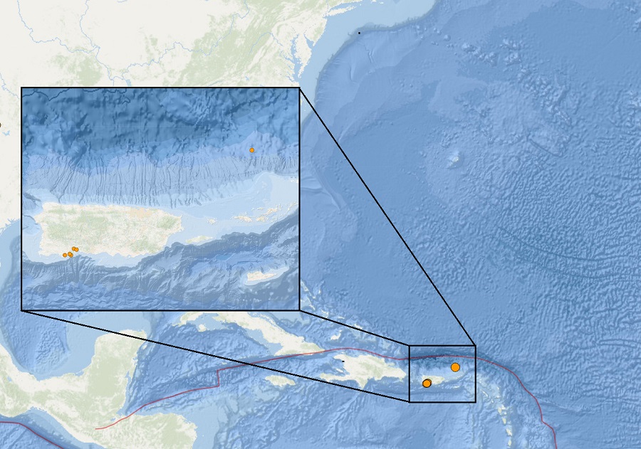
SAN JUAN — A series of earthquakes have rattled Puerto Rico and the U.S. Virgin Islands over the last week; fortunately, there was no tsunami threat from the seismic activity.
The five earthquakes in Puerto Rico have been relatively light. The first was a 2.2 located a mile outside of Guanica. The second was a 2.3 located about a mile and a half from Guayanilla. The second was followed by a third centered right in Guayanilla with a magnitude of 2.6. A pair of quakes shook just outside of Maria Antonia, the first being a 2.2 and the last being a 2.8.
The Puerto Rico earthquakes are likely continued aftershocks from a strong earthquake that struck the island in January 2020. That 6.4 created extensive damage in Puerto Rico, including widespread power failures across much of the island. An earthquake swarm started here in December 2019 and unrest has continued since.
Roughly 50 miles north of Charlotte Amalie in the U.S. Virgin Islands, a stronger 3.5 earthquake struck. This earthquake does not appear to be related to the ongoing seismic activity in Puerto Rico.

These earthquakes are occurring near the northern edge of the Caribbean Plate, a mostly oceanic tectonic plate underlying Central America and the Caribbean Sea off of the north coast of South America. The Caribbean Plate borders the North American Plate, the South American Plate, the Nazca Plate, and the Cocos Plate. The borders of these plates are home to ongoing seismic activity, including frequent earthquakes, occasional tsunamis, and sometimes even volcanic eruptions.
The La Soufriere Volcano is erupting today on the eastern edge of the Caribbean plate, one of many active volcanoes that line that boundary area. Heavy ash fall and sulphuric gasses are blowing about from today’s eruption around St. Vincent, the Grenadines, and Barbados.
However, the earthquakes in Puerto Rico and the U.S. Virgin Islands is not related to the volcanic activity in St. Vincent. While they are around the same tectonic plate, they are too far apart to be related.
Because of the seismic hazards that exist in this part of the world, the U.S. and other Caribbean governments participated in an earthquake and tsunami drills here just weeks ago. On March 11, through the CaribeWave ’21 Tsunami Warning System Exercise, officials drilled for two hypothetical earthquakes, an 8.0 and an 8.5. In that drill exercise, a simulated tsunami struck portions of Jamaica, Haiti, Cuba, and portions of Central and South America and beyond.
Days later, on March 17, another significant earthquake and tsunami drill was held. Unlike the CaribeWave ’21 event which focuses on preparedness in the Caribbean, the March 17 LANTEX 21 drill was designed to prepare the rest of the North American Coast for tsunami dangers. The March 17 LANTEX21 drill simulated an even more powerful 8.8 earthquake in the North Atlantic. If such a quake were to occur, a potentially destructive tsunami towards the U.S. and Canadian East Coasts would be possible.