MIAMI — Tropical Storm Debby was drifting over the Atlantic off the Carolinas early today and is expected to turn back toward South Carolina for a second landfall, the National Hurricane Center says. It is forecast to then slowly make its way north, bringing heavy rainfall and flooding.
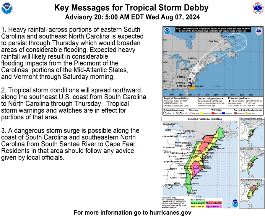
On the forecast track, Debby would reach the South Carolina coast “by tonight or early Thursday,” the hurricane center said. “A faster motion toward the north and north-northeast across the Carolinas and the U.S. Mid-Atlantic region is expected on Thursday and Friday.
“Some strengthening is possible today or tonight before the center of Debby reaches the coast of South Carolina,” forecasters said. “Weakening is forecast to begin on Thursday after the center moves inland.”
Debby could move up the middle of North Carolina, through Virginia and into the Washington area by Saturday, the center added.
Debby was about 65 miles south-southeast of Charleston, South Carolina, early Wednesday and about 90 miles east of Savannah, Georgia. It was crawling east at a mere 5 mph, with maximum sustained winds of 45 mph.

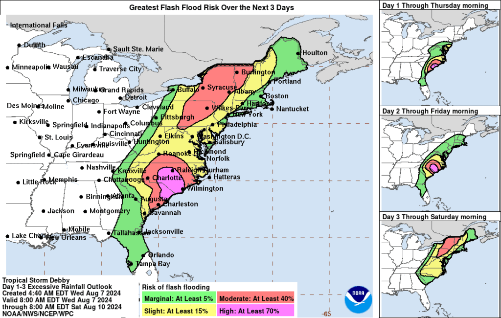
The storm’s sluggish pace means flood risks are high across the region and could persist in some areas well into the weekend.
Debby first hit land Monday morning as a Category 1 hurricane over Florida’s Big Bend coast and left a trail of inundation in its wake despite weakening shortly after landfall.
Although forecasters said Debby would likely gain power while offshore, the strengthening should be moderate as long as it remains near the coast, as expected, which would mean limited interaction with warmer Gulf Stream waters. Forecasters anticipated tropical storm conditions would continue along the coast of South Carolina through tomorrow night.
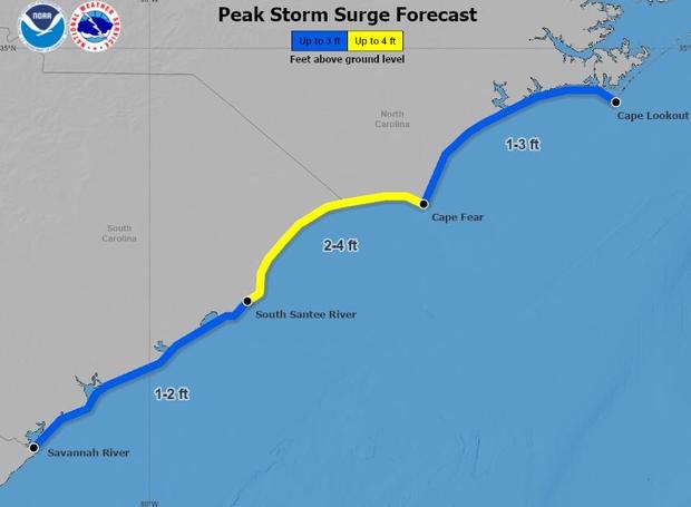
Storm surge forecast
The map below, updated late Tuesday, shows the highest potential peak storm surge heights, including tides. Forecasters noted that the timing of peak surge and high tide in a given area, and whether they coincide or not, will ultimately determine how destructive the inundation will be.

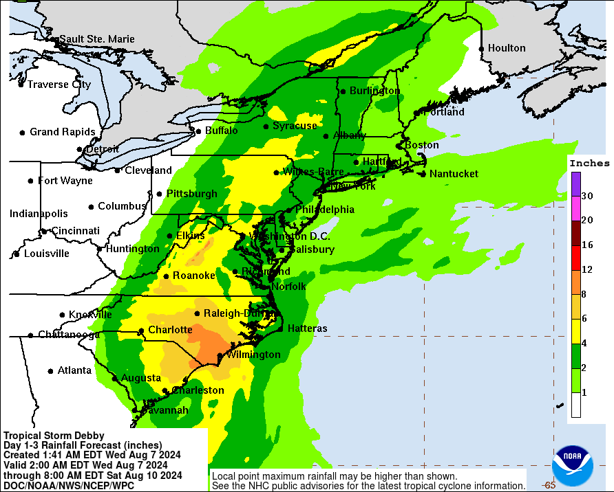
Heavy rainfall totals dominate the forecast
Debby moved slowly Tuesday, and the hurricane center had anticipated rainfall totals along its path to be massive in part because the storm is lingering over each place it passes.
As Debby shifts farther east, the storm is expected to touch an expansive area, bringing the risk of torrential rain and flooding as far north as New England through Saturday.
While the storm had already brought unprecedented rainfall to Georgia and South Carolina, officials in parts of Florida said they were grappling with the aftermath of record rainfall, too, and preparing for more throughout the week.

Southwestern Gulf of Mexico
Disorganized showers and thunderstorms located over the southwestern Caribbean sea are associated with a tropical wave.
The northern portion of this tropical wave could reach the southwestern Gulf of Mexico over the weekend, however, any development of this system should be slow to occur.
* Formation chance through 48 hours…low…near 0 percent.
* Formation chance through 7 days…low…10 percent.
