
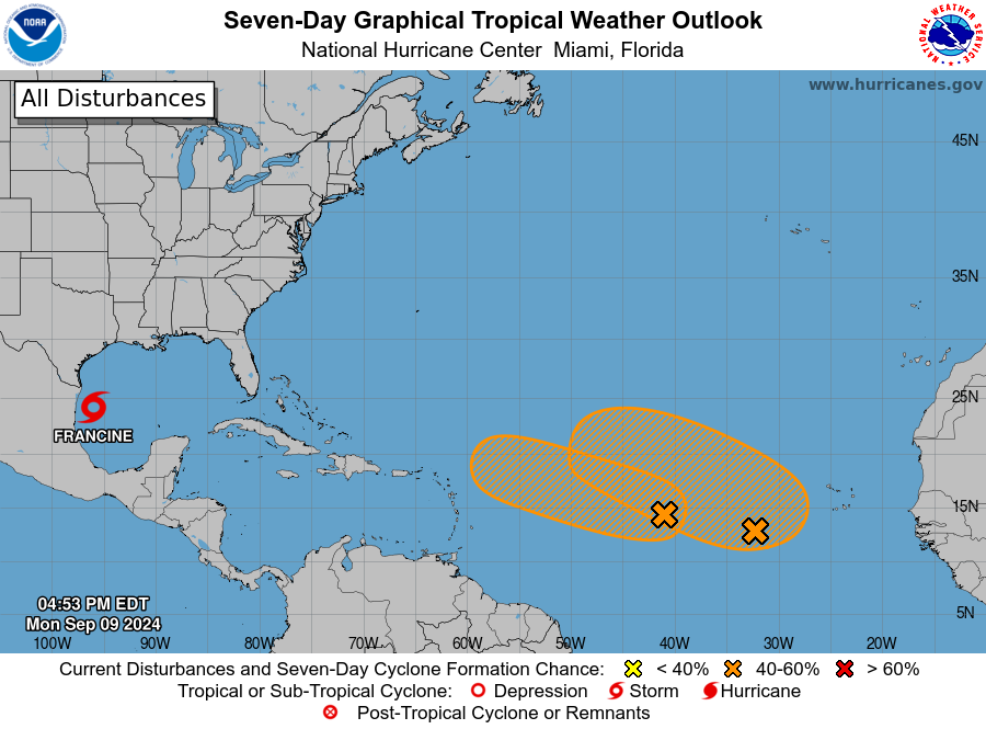
MIAMI — The National Hurricane Center (NHC) continues to track two more areas in the Atlantic that could become the next named storm of the 2024 Atlantic hurricane season.
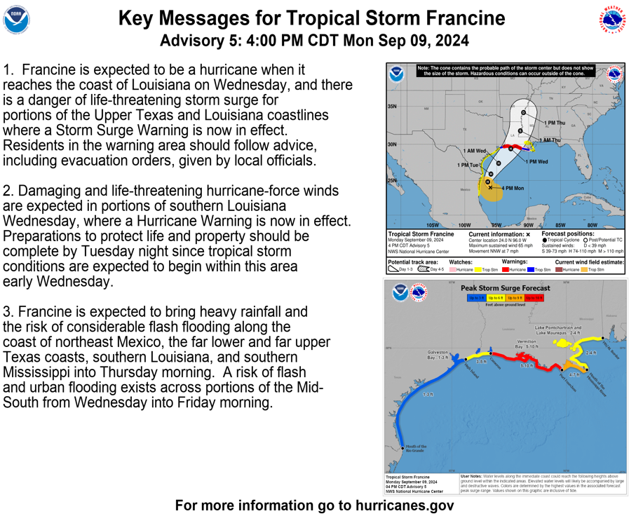
Tropical Storm Francine is forecast to become a Category 2 hurricane in the Gulf of Mexico and make landfall in Louisiana on Wednesday.
Each system has a high chance of developing over the next several days, putting the Gulf and Atlantic coasts of the U.S. on alert as peak hurricane season approaches.
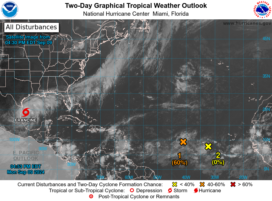
A trough of low pressure that was barely clinging to tropical relevance in the central Atlantic has perked back up again according to the long-range development odds given by the NHC.
The NHC said showers and thunderstorms associated with Invest 92-L over the central tropical Atlantic are continuing to show signs of gradual organization.
Environmental conditions appear conducive for additional development of Invest 92-L, and a tropical depression could form while the system spins over the central Atlantic through the beginning of the new workweek, and then generally moves west through the rest of the week.
The NHC is giving Invest 92-L a high chance of developing. If this system’s strengthening continues, it could become either Tropical Storm Francine or Gordon, depending on whether Potential Tropical Cyclone Six or Invest 92-L becomes a tropical storm first.
Another area to watch in eastern Atlantic
The NHC is also monitoring another area in the eastern Atlantic, with a trough of low pressure located several hundred miles east-southeast of the Cabo Verde Islands.
According to the NHC, this tropical disturbance is expected to move very little over the next few days until it potentially interacts with a tropical disturbance that is forecast to move off the western coast of Africa early this week.
Environmental conditions are expected to be favorable for further development, and a tropical depression could form in the middle or latter part of the week.
The NHC is giving this tropical disturbance a medium chance of developing over the next week.