MIAMI — The National Hurricane Center is tracking three systems in the Atlantic basin as the remnants of Francine make their way farther north.
Elsewhere in the Atlantic basin, forecasters are tracking:
- Tropical Depression Seven in the eastern Atlantic
- Invest 94L near the northern Leeward Islands
- Disturbance a few hundred miles off Florida and the southeastern U.S.
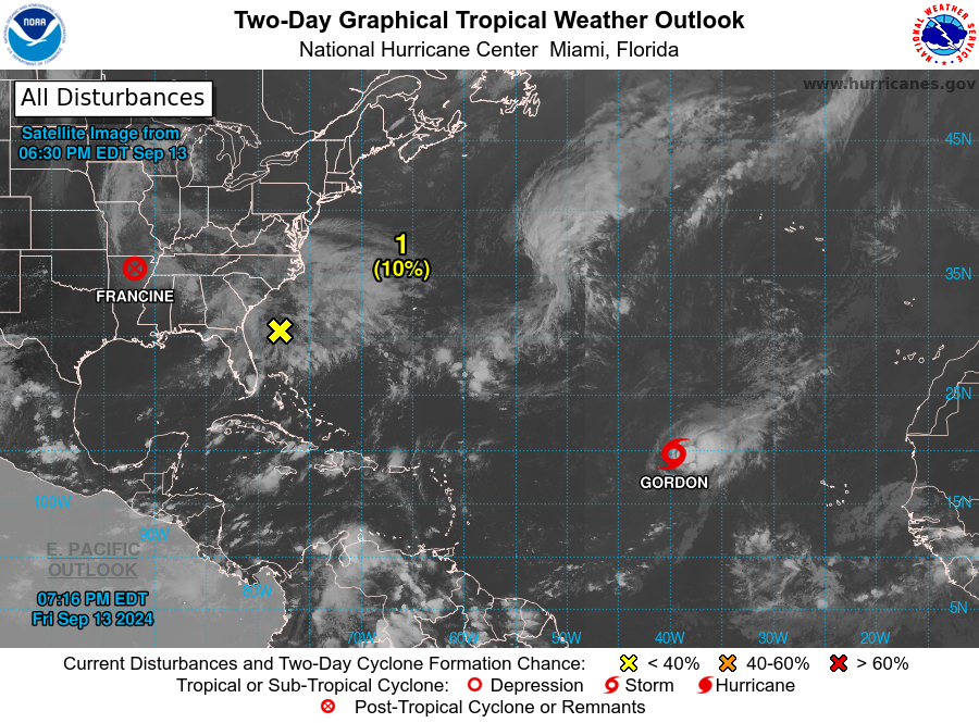
Invest 94L, east of the Leeward Islands
Satellite-derived wind data from several hours ago indicate thata small area of low pressure located less than one hundred miles east of the northern Leeward Islands has degenerated into a surface trough.
Environmental conditions, including the proximity of dry air, do not favor development of this system while it moveswest-northwestward at about 15 mph. Regardless of development, locally heavy rainfall and gusty winds are possible across the northern Leeward Islands today.
- Formation chance through 48 hours: low, 20 percent.
- Formation chance through 7 days: low, 20 percent.
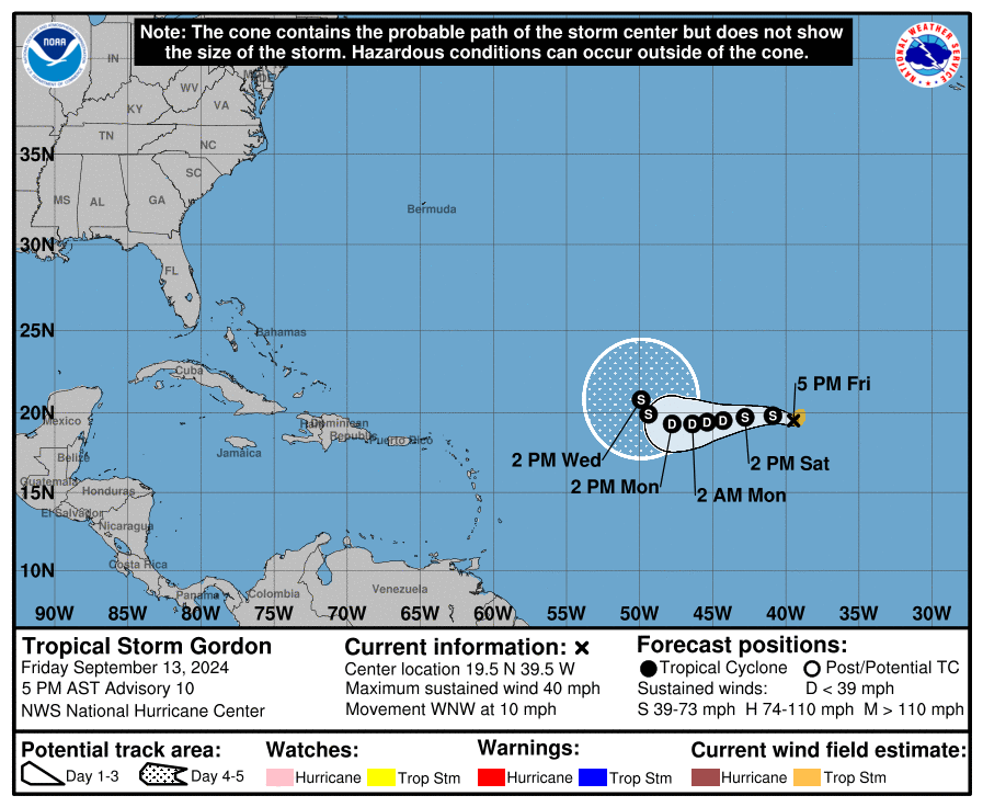
Tropical Depression 7 to be Tropical Storm Gordon today
Here’s the latest update from the NHC as of 5 a.m. EDT September13:
- Location: 955 miles west-northwest of Cabo Verde Islands
- Maximum sustained winds: 35 mph
- Movement: west-northwest at 14 mph
- Pressure: 1007 mb
At 5 a.m. AST, the center of Tropical Depression Seven was located near latitude 19.0 North, longitude 38.2 West.
The depression is moving toward the west-northwest near 14 mph. A turn toward the west is forecast by tonight, with the system gradually slowing down through the weekend.
Maximum sustained winds are near 35 mph, with higher gusts.
The depression could become a tropical storm later today, however little change in strength overall is anticipated through the weekend.
Tropical Depression Seven is expected to become Tropical Storm Gordon today but don’t expect any impacts from the system in the U.S., according to Alex DaSilva, AccuWeather lead hurricane forecaster.
“This will not bother anyone, except maybe shipping,” DaSilva said in a telephone interview Thursday. “It will stay in the Atlantic and pose no threat to the U.S.
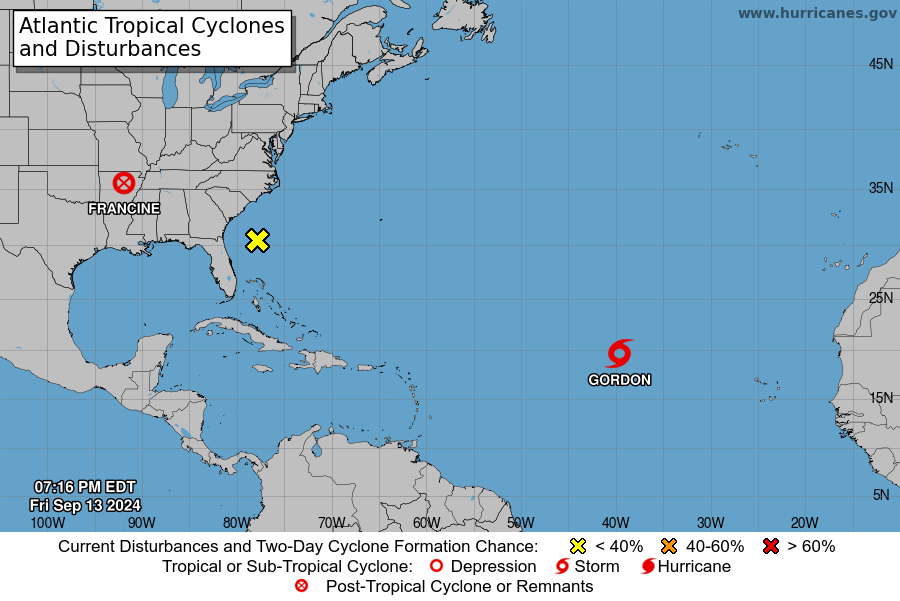
Offshore the Southeastern U.S. over the western Atlantic
A non-tropical area of low pressure could form along a frontal boundary a few hundred miles off the southeastern U.S. coastline this weekend.
Thereafter, some subtropical or tropical development is possible during the early part of next week while the system moves generally northwestward toward the coast.
- Formation chance through 48 hours: low, near 0 percent.
- Formation chance through 7 days: low, 30 percent.
Meanwhile, the remnants from what is now Post-Tropical Cyclone Francine are bringing heavy rain and the risk for flash floods to portions of the Tennessee Valley and the Southeast this morning.
Francine made landfall Wednesday night as a Category 2 storm in Terrebonne Parish in Louisiana with maximum sustained winds near 100 mph.