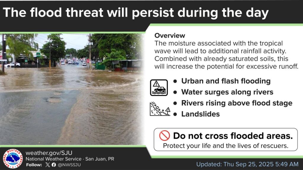
![]() Flood threat continues today
Flood threat continues today
![]() Risks of heavy rain and flooding persist
Risks of heavy rain and flooding persist
![]() Possible Flooding – Stay Alert and Safe
Possible Flooding – Stay Alert and Safe
![]() Do not cross flooded areas
Do not cross flooded areas
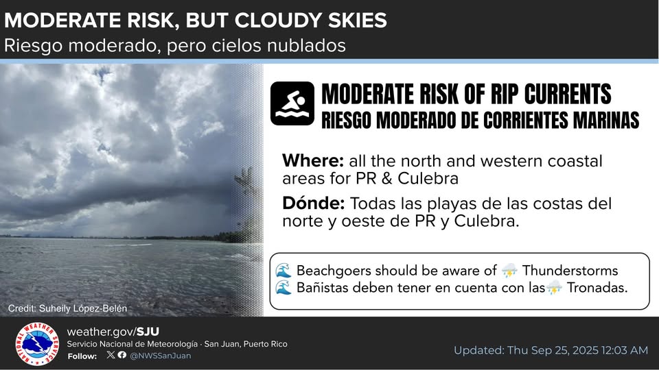
There is a moderate risk of rip currents along the northern and northwestern coasts, as well as in Culebra, with a low risk for the rest of the coastal areas.
Although coastal conditions are generally suitable for beachgoers, cloudy skies and a high chance of thunderstorms may pose a hazard across the coastal areas.
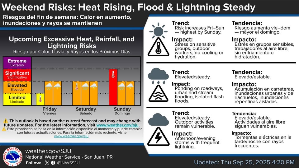
![]() Heat risk is rising into the weekend — stay hydrated and plan ahead!
Heat risk is rising into the weekend — stay hydrated and plan ahead!
![]() Flood and Lightning risks remain elevated — use caution outdoors.
Flood and Lightning risks remain elevated — use caution outdoors.
![]() Stay informed : weather.gov/sju
Stay informed : weather.gov/sju
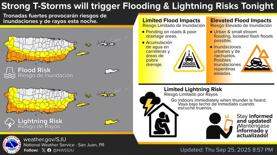
![]() Strong storms tonight = Flooding
Strong storms tonight = Flooding ![]() + Lightning
+ Lightning ![]() risks
risks
![]() Flood: Ponding, urban/stream flooding possible.
Flood: Ponding, urban/stream flooding possible.
![]() Lightning: Go indoors when thunder roars.
Lightning: Go indoors when thunder roars.
![]() Severe Thunderstorms tonight = Flooding
Severe Thunderstorms tonight = Flooding ![]() and Lightning
and Lightning ![]() risks
risks
![]() Flooding: Roads and streams affected.
Flooding: Roads and streams affected.
![]() Lightning: Go under the ceiling when you hear thunder.
Lightning: Go under the ceiling when you hear thunder.
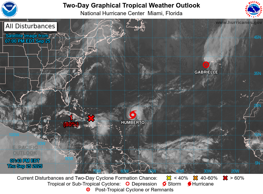
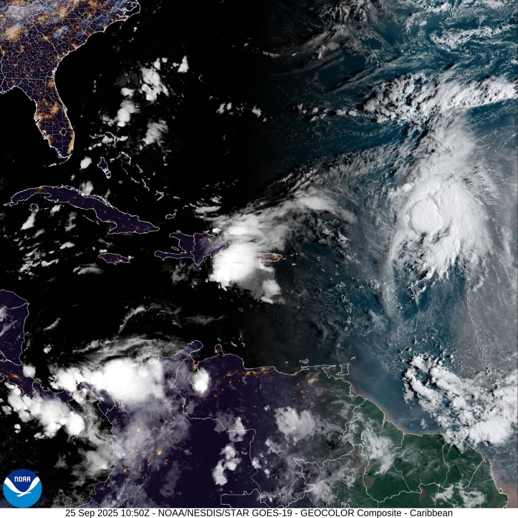
Active Systems
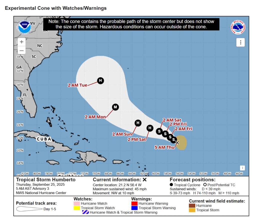
The National Hurricane Center is issuing advisories on Hurricane Gabrielle, located over the central subtropical Atlantic, and on Tropical Storm Humberto, located several hundred miles east-northeast of the northern Leeward Islands.
Eastern Caribbean Sea (Invest 94L)
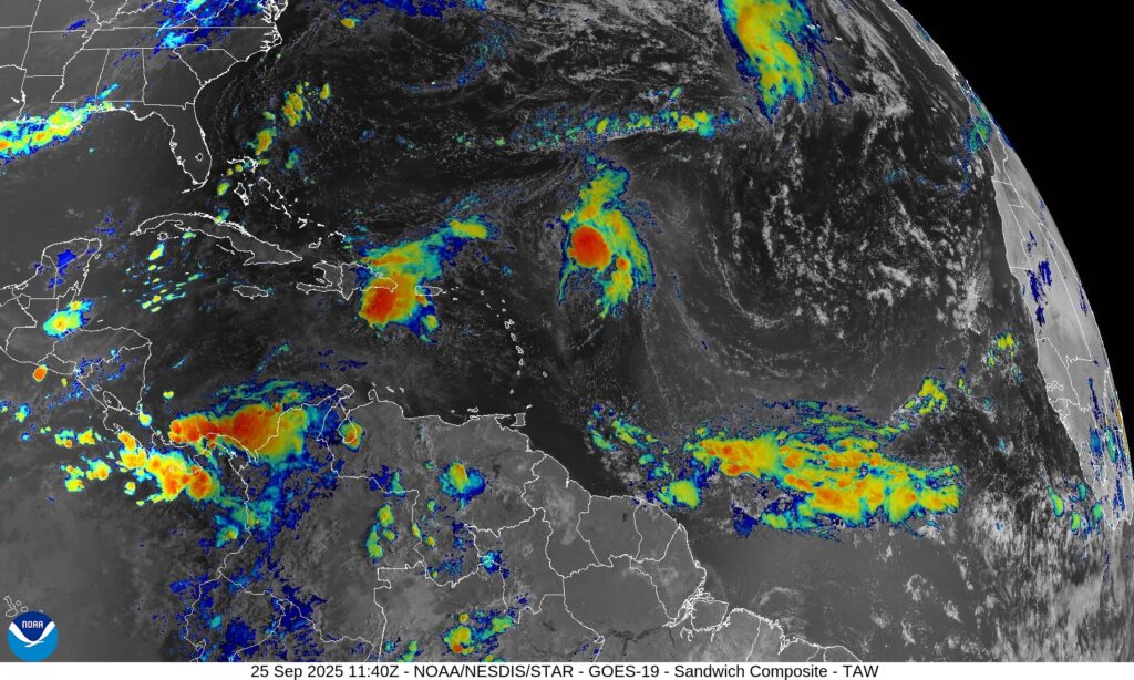
A tropical wave centered near the Dominican Republic continues to produces widespread disorganized showers and thunderstorms.
The wave is expected to move west-northwestward around 10 to 15 mph, spreading heavy rainfall and gusty winds across Puerto Rico and the Dominican Republic through today.
The system is then expected to slow down and turn northwestward when it reaches the southwestern
Atlantic.
A tropical depression is likely to form when the disturbance is in the vicinity of the Bahamas late this week.
Interests in Puerto Rico, the Dominican Republic, Haiti, the Turks and Caicos Islands, and the Bahamas should monitor the progress of this system.
* Formation chance through 48 hours…medium…50 percent.
* Formation chance through 7 days…high…80 percent.