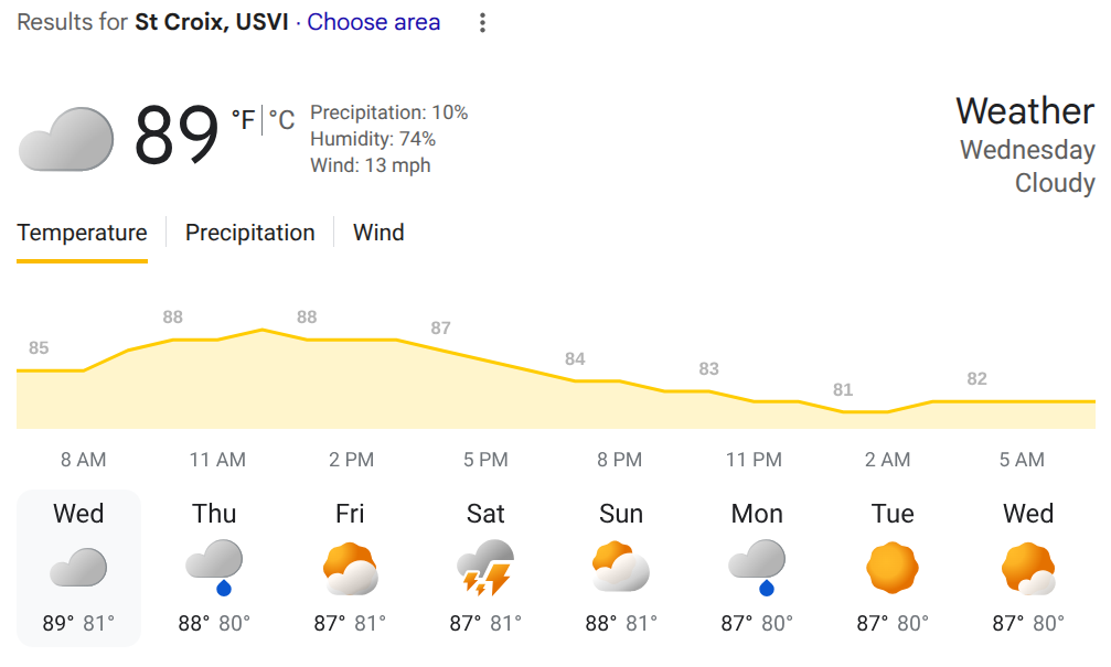
For St. Croix, breezy with a touch of rain this morning; otherwise, clouds yielding to some sun with a high of 91, AccuWeather said.
Tonight our island can expect partly cloudy conditions and a low of 78, according to AccuWeather.
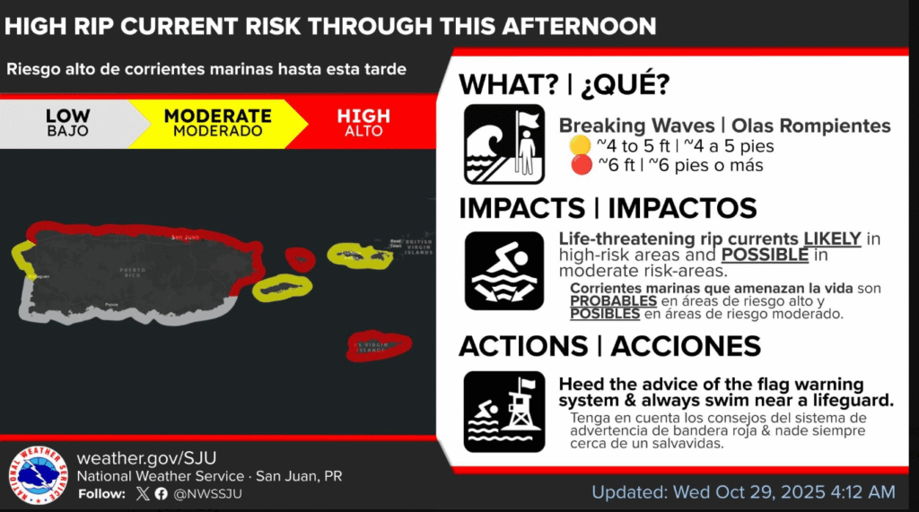
There is a high rip current risk through this afternoon for St. Croix, Culebra and the northern and eastern beaches of Puerto Rico.
HIGH RIP CURRENT RISK IN EFFECT THROUGH THIS AFTERNOON
* WHAT…High Rip Current Risk, life-threatening rip current.
* WHERE…the north and east-facing beaches in St Croix.
* WHEN…Through this evening at 6 PM AST.
* IMPACTS…Rip currents can sweep even the best swimmers away from shore into deeper water, where it becomes difficult to return to safety.
PRECAUTIONARY/PREPAREDNESS ACTIONS
There is a high risk of rip currents.
Rip currents are powerful channels of water flowing quickly away from shore, which occur most often at low spots or breaks in the sandbar and in the vicinity of structures such as groins, jetties and piers. Heed the advice of lifeguards, beach patrol flags and signs.
If you become caught in a rip current, yell for help. Remain calm, do not exhaust yourself and stay afloat while waiting for help. If you have to swim out of a rip current, swim parallel to shore and back toward the beach when possible. Do not attempt to swim directly against a rip current as you will tire quickly.
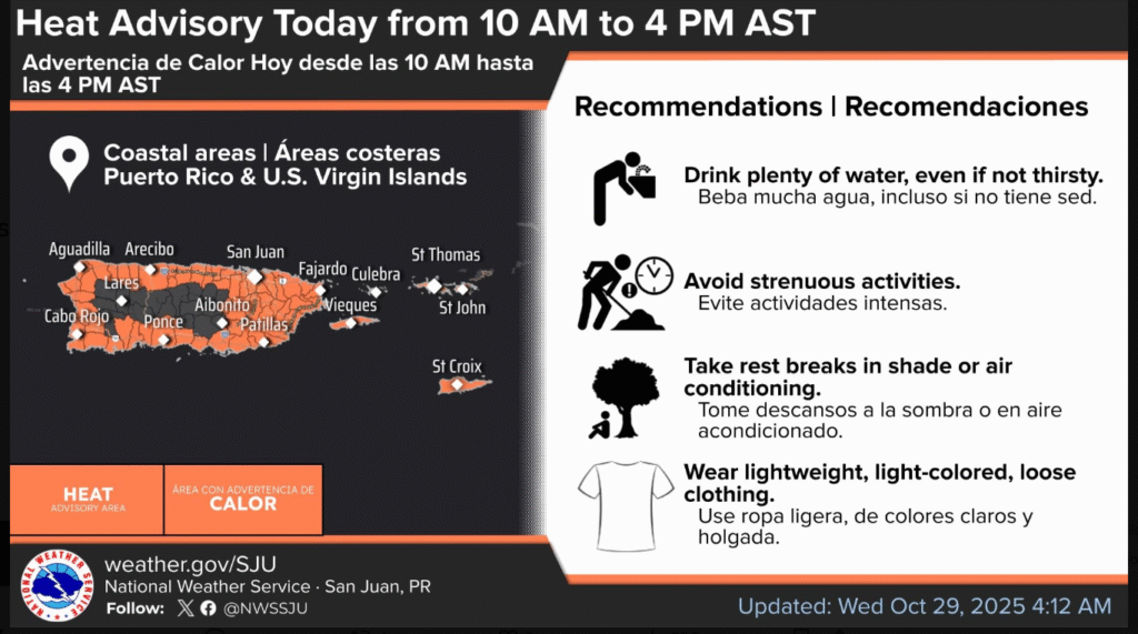
A Heat Advisory has been issued for the coastal and urban areas of the U.S. Virgin Islands and Puerto Rico from 10 AM to 4 PM AST.
The NWS suggests you follow the recommendations delineated in this graphic to avoid heat exhaustion!
HEAT ADVISORY IN EFFECT FROM 10 AM THIS MORNING TO 4 PM AST THIS AFTERNOON
* WHAT…This level of heat affect most individuals sensitive to heat, especially those without effective cooling and/or adequate hydration. Impacts possible in some health system and in heat-sensitive industries.
* WHERE…Portions of Puerto Rico and Virgin Islands.
* WHEN…From 10 AM this morning to 4 PM AST this afternoon.
* IMPACTS…Hot temperatures and high humidity may cause heat illnesses.
PRECAUTIONARY/PREPAREDNESS ACTIONS
Drink plenty of fluids, stay in an air-conditioned room, stay out of the sun, and check up on relatives and neighbors.
Longer term forecast
Mainly fair weather conditions will persist through the weekend due to the influence of a surface high pressure over the central Atlantic that will promote drier and stable conditions aloft, the National Weather Service said.
However, passing showers are expected each day across the islands, according to the NWS.
A tropical wave will approach the region by late Saturday into Sunday, increasing the potential for showers and isolated thunderstorms, the NWS said.
Heat remains limited to elevated through most of the week. Marine conditions will turn choppy to hazardous as northerly swells arrive, with a moderate to high rip current risk, according to the NWS.