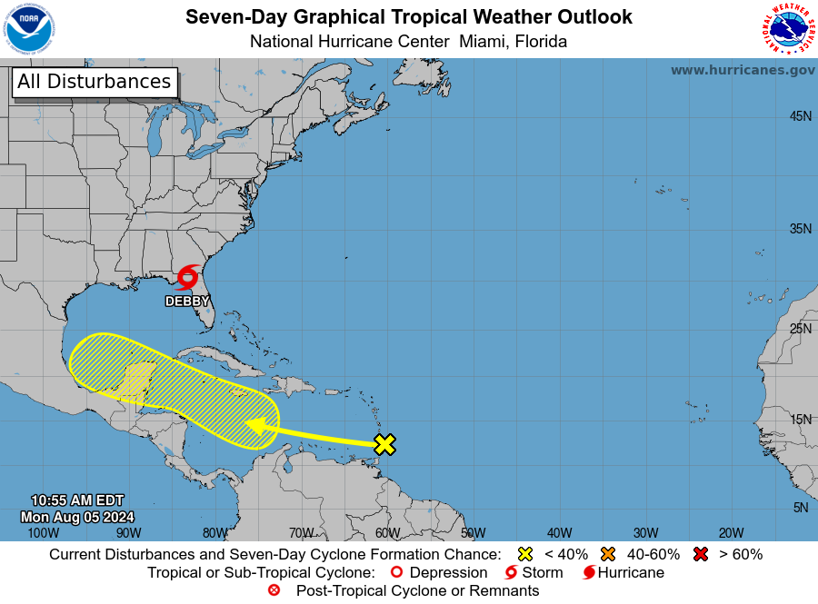
MIAMI — A tropical wave located near the Windward Islands continues to produce disorganized showers and thunderstorms.
Environmental conditions appear generally favorable for some slow development over the next week while the system moves westward at around 20 mph over the Caribbean Sea.
* Formation chance through 48 hours…low…10 percent.
* Formation chance through 7 days…low…30 percent.

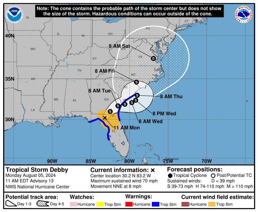
Meanwhile, the National Hurricane Center has issued advisories on recently upgraded Hurricane Debby.
Debby made landfall in Florida’s Big Bend region this morning. Being over land, will halt its forward speed and could result in historically heavy rainfall triggering flooding in parts of the Southeast.
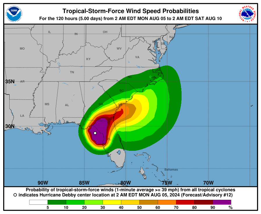
Dangerous storm surge, strong winds gusts and a few tornadoes are also accompanying Debby.
Debby made landfall near Steinhatchee, Florida, with maximum sustained winds of 80 mph at 7:00 a.m. EDT, according to the NHC.

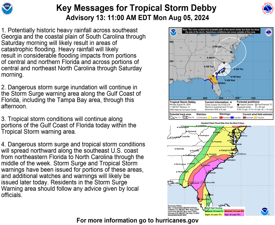
‘Historic’ flooding risk
NOAA has issued their highest level of flood outlook for the next few days, shown in pink on the maps below. These areas could experience damaging and life-threatening flooding flash flooding and river flooding
The National Hurricane Center stated in their Monday morning discussion that “potentially historic heavy rainfall across southeast Georgia and the coastal plain of South Carolina through Saturday morning will likely result in areas of catastrophic flooding.”
Flooding from rainfall could be exacerbated by winds blowing onshore along the Southeast coast. That can prevent floodwaters from draining away toward the ocean.


