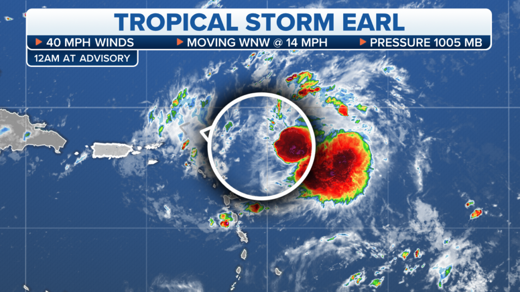
MIAMI — Forecasters say Tropical Storm Earl formed east of the Northern Leeward Islands late Friday and is threatening heavy rains and gusty squalls in the region.
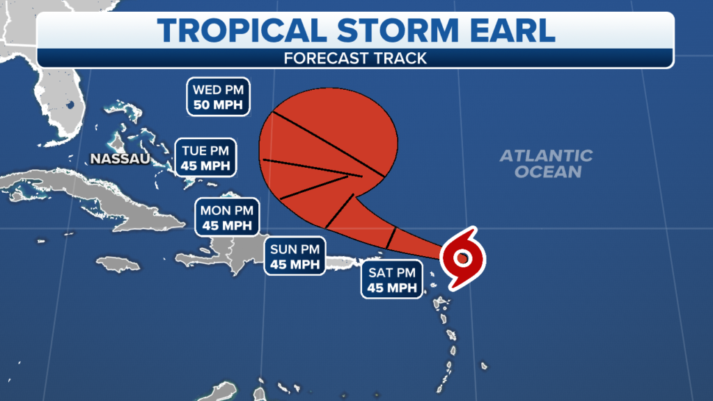
The U.S. National Hurricane Center in Miami said Earl was headed generally west-northwest on a course expected to take it near or just north of the Northern Leeward Islands on Saturday.
By 11 p.m. EDT Friday, the storm was centered about 185 miles (295 kilometers) east of the Northern Leeward Islands and had top sustained winds of 40 mph (65 kph).

Forecasters said some slight strengthening was possible in the next few days.
The center said Earl was first expected to initially spread heavy rains over the Leeward Islands, and then also Puerto Rico and the British and U.S. Virgin Islands as it was forecast to move north of those other islands Saturday night and early Sunday. It said some rivers and streams could rise rapidly in Puerto Rico, raising the threat of flash flooding, and there was a threat of gusty squalls along the storm’s path.
The storm was headed to the west-northwest at 14 mph (22 kph).
The storm sits quite far north in an area of warmer-than-usual water but is no threat to land. Its closest reference point is about 885 miles west of the Azores.
Forecasts indicate it will continue strengthening over the weekend and reach a peak intensity of about 85 mph by Sunday morning as it drifts toward the northeast. The cyclone will eventually enter cooler waters and weaken early next week.
Tropical Storm Earl
The cyclone will eventually enter cooler waters and weaken early next week.

The cyclone is expected to stay north of the Caribbean Islands but could increase rains and swells through the weekend.
The system is not expected to be a threat the Southeast and is forecast to safely make a turn away from U.S. next week.
[wpedon id=23995]