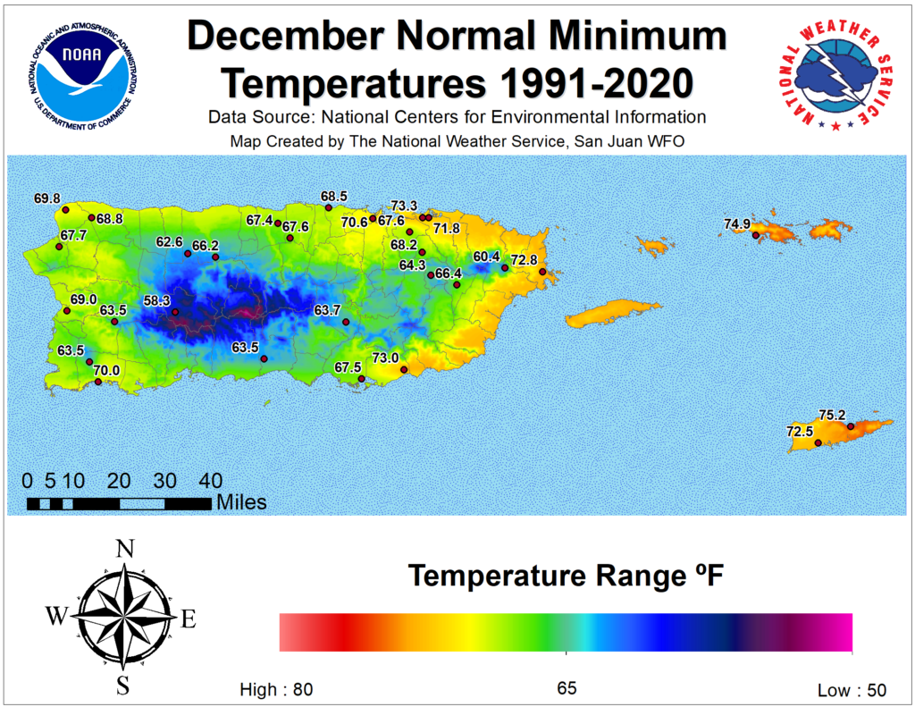
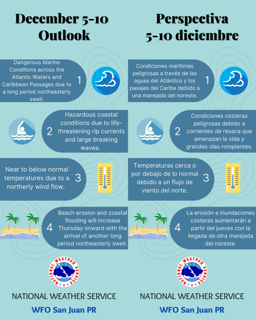
SAN JUAN — Under a north-to-north-northeasterly wind flow, temperatures will remain near to below normal throughout the week for our area, the National Weather Service said.
Hazardous marine and coastal conditions will prevail throughout the work-week, increasing the risk of coastal flooding and beach erosion Thursday through the weekend, according to the NWS forecaster Carlos Anselmi-Molina based in Puerto Rico.
Special Tropical Weather Outlook issued to discuss the potential for subtropical development this week over the central Atlantic. 1. Central Subtropical Atlantic: A large and complex area of low pressure located over the central subtropical Atlantic about 800 miles northeast of the northern Leeward Islands continues to produce a broad area of disorganized showers and thunderstorms. Environmental conditions appear conducive for this system to acquire some subtropical or tropical characteristics while it meanders generally northeastward during the next few days.
By Friday, the low is expected to move over cooler waters and interact with a mid-latitude trough, limiting potential of tropical transition after that time. Additional information on this system, including gale warnings, can be found in High Seas Forecasts issued by the National Weather Service. The next Special Tropical Weather Outlook on this system will be issued by 9 AM EST Tuesday, or earlier, if necessary. * Formation chance through 48 hours…medium…40 percent. * Formation chance through 5 days…medium…50 percent.
[wpedon id=23995]