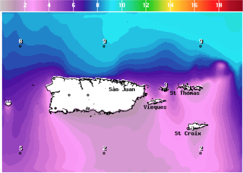
SAN JUAN — Northerly swells began affecting the regional waters last night and will continue throughout the weekend, generating hazardous marine and life-threatening coastal conditions, the National Weather Service said.
These conditions will trigger Small Craft Advisory, High Surf Advisory, Coastal Flood Advisory criteria, and high rip current risk conditions, according to the NWS.

Potential Hazards and Impacts
● Marine: Building seas of up to 10 feet with occasional seas of up to 11 feet, especially across the
Atlantic waters and local passages.
○ Impacts: Marine conditions that are hazardous to small craft.
○ Small Craft Advisories are in effect through at least Sunday evening.
● Surf Zone: Breaking waves reaching the 10 to 16 feet range, with the highest breaking waves in
beaches with northern exposure across northern Puerto Rico, Culebra, and the northern U.S. Virgin Islands.

○ Impacts: Flooding of lots, parks, and roads with only isolated road closures expected. Dangerous swimming and surfing conditions and localized beach erosion. Rip currents can sweep even the best swimmers away from shore into deeper water.
○ High Rip Current Risk in effect through at least Sunday evening for beaches between Rincon eastward to Ceiba across northern Puerto Rico, Vieques, Culebra, and all the U.S. Virgin Islands.
○ High Surf Advisory is in effect through at least 6 PM AST Sunday for beaches between Aguadilla eastward to Fajardo across northern Puerto Rico, Culebra, and the northern U.S. Virgin Islands.
○ Coastal Flood Advisory is in effect through at least 6 PM AST Friday for beaches
between Aguadilla eastward to Fajardo across northern Puerto Rico.


