SAN JUAN — An upper level trough and induced lower level trough will continue to move across the region today alongside a mass of relatively drier air.
![]()
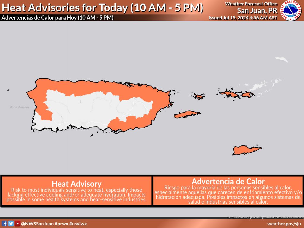
![]() Hot, hazy and humid conditions will persist with another extensive plume of Saharan dust forecast to affect the region by mid week. These conditions may produce maximum heat indices above 108-110 degrees in lower elevation areas.
Hot, hazy and humid conditions will persist with another extensive plume of Saharan dust forecast to affect the region by mid week. These conditions may produce maximum heat indices above 108-110 degrees in lower elevation areas.
![]()
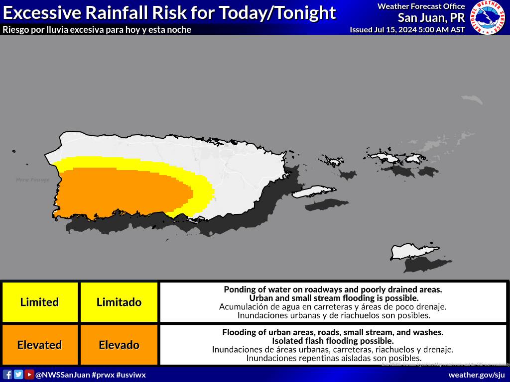
![]() Daytime heating along with local sea breeze variations and the proximity of the upper trough will aid in afternoon shower and thunderstorm development particularly across the interior and southwest sections of Puerto Rico, as well as over the coastal waters and local passages today.
Daytime heating along with local sea breeze variations and the proximity of the upper trough will aid in afternoon shower and thunderstorm development particularly across the interior and southwest sections of Puerto Rico, as well as over the coastal waters and local passages today.
![]() The risk for rip currents is low, however, life-threatening rip currents often occur in the vicinity of jetties and piers.
The risk for rip currents is low, however, life-threatening rip currents often occur in the vicinity of jetties and piers.
“A couple spots I’m watching in the Atlantic, a couple tropical waves, it’s normal to have those areas of thunderstorms this time of year, but they are going to bring us increased rain — and down the road, there could be a little development out of one of them, so I am going to monitor that,” Meteorologist Brian Shields said today.
No tropical cyclone formation is expected over the next seven days.