Going to the beach this weekend?
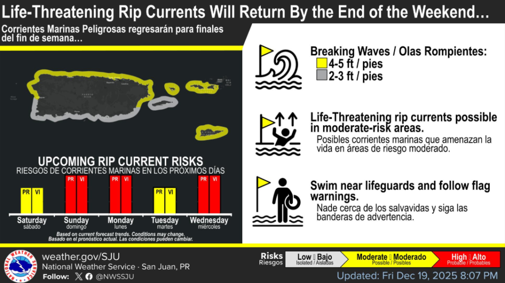
Life-threatening rip current will likely return by Sunday, check the beach forecast before you go!
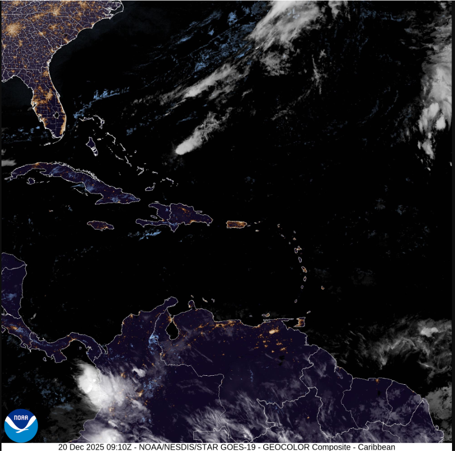
Mainly fair weather with localized afternoon showers, mainly across interior and western Puerto Rico, the National Weather Service said.
A northeasterly long period swell will deteriorate marine and coastal conditions during the weekend, according to the NWS.
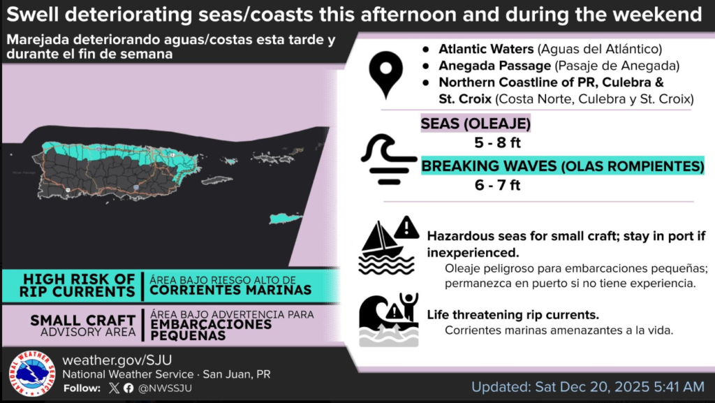
HIGH RISK OF RIP CURRENTS FROM THIS EVENING THROUGH LATE SUNDAY NIGHT
* WHAT…High Rip Current Risk, life-threatening rip currents.
* WHERE…North-facing beaches of Puerto Rico, Culebra, and St. Croix.
* WHEN…From this evening through late Sunday night.
* IMPACTS…Rip currents can sweep even the best swimmers away from shore into deeper water, where it becomes difficult to return to safety.
PRECAUTIONARY/PREPAREDNESS ACTIONS
There is a high risk of rip currents. Rip currents are powerful channels of water flowing quickly away from shore, which occur most often at low spots or breaks in the sandbar and in the vicinity of structures such as groins, jetties and piers. Heed the advice of lifeguards, beach patrol flags and signs.
If you become caught in a rip current, yell for help. Remain calm, do not exhaust yourself and stay afloat while waiting for help. If you have to swim out of a rip current, swim parallel to shore and back toward the beach when possible. Do not attempt to swim directly against a rip current as you will tire quickly.

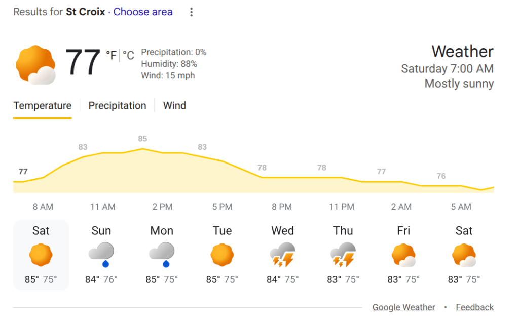
Today St. Croix will be most sunny and breezy this morning with a high of 86, AccuWeather said.
Tonight St. Croix will experience mostly clear conditions and a low of 76, according to AccuWeather.
Enjoy the day! But remember: Beach conditions will start to deteriorate this afternoon as a swell arrives!
Marine Forecast St. Croix this week
Today
East winds 10 to 15 knots with gusts up to 25 knots. Seas 4 to 5 feet. Wave detail: east 4 feet at 6 seconds and east 3 feet at 10 seconds. Scattered showers early this morning, then isolated showers late this morning and early afternoon. Scattered showers late.
Tonight
East winds 15 to 20 knots with gusts up to 25 knots. Seas 4 to 5 feet. Wave detail: east 4 feet at 6 seconds and east 3 feet at 10 seconds.
Sunday
East winds 15 to 20 knots with gusts up to 25 knots. Seas around 5 feet. Wave detail: east 5 feet at 6 seconds and east 2 feet at 10 seconds.
Sunday Night
East winds around 15 knots with gusts up to 25 knots. Seas 4 to 5 feet. Wave detail: east 5 feet at 6 seconds and northeast 2 feet at 10 seconds. Scattered showers.
Monday
East winds 10 to 15 knots with gusts up to 25 knots. Seas 4 to 5 feet. Wave detail: east 4 feet at 6 seconds and northeast 2 feet at 10 seconds.
Monday Night
Northeast winds 10 to 15 knots, increasing to 15 to 20 knots after midnight. Seas around 4 feet. Wave detail: east 4 feet at 6 seconds and northeast 3 feet at 10 seconds. Scattered showers.
Tuesday
Northeast winds 15 to 20 knots. Seas around 4 feet.
Tuesday Night
Northeast winds 15 to 20 knots. Seas 4 to 5 feet. Scattered showers.
Wednesday
East winds 15 to 20 knots, diminishing to 10 to 15 knots in the afternoon. Seas 4 to 5 feet.
Wednesday Night
Northeast winds 10 to 15 knots. Seas around 4 feet. Scattered showers.